Area Overview for HP1 2JP
Photos of HP1 2JP


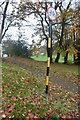
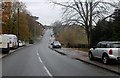
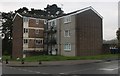
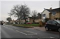
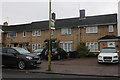
11 photos from this area
Area Information
Key information about the HP1 2JP including its size, population, and administrative classification.
- Area Type
- Postcode
- Area Size
- 7223 m²
- Population
- 1962
- Population Density
- 3911 people/km²
House Prices in HP1 2JP
25
Properties
£282,268
Average Sold Price
£68,000
Lowest Price
£461,000
Highest Price
Showing 25 properties
| Address | Type | Beds | Baths | Last Sale Price | Last Sale Date | |
|---|---|---|---|---|---|---|
| 22 Aubreys Road, Hemel Hempstead, HP1 2JP | Terraced | 3 | 1 | £350,000 | Apr 2024 | |
| 24 Aubreys Road, Hemel Hempstead, HP1 2JP | Terraced | 3 | 1 | £380,000 | Nov 2023 | |
| 10 Aubreys Road, Hemel Hempstead, HP1 2JP | house | - | - | £461,000 | May 2022 | |
| 3 Aubreys Road, Hemel Hempstead, HP1 2JP | Terraced | 2 | 1 | £340,000 | Jul 2021 | |
| 20 Aubreys Road, Hemel Hempstead, HP1 2JP | Detached | 3 | 1 | £365,000 | Mar 2021 | |
| 8 Aubreys Road, Hemel Hempstead, HP1 2JP | Terraced | 3 | 1 | £376,000 | Dec 2019 | |
| 7 Aubreys Road, Hemel Hempstead, HP1 2JP | house | 2 | 1 | £285,000 | Mar 2016 | |
| 13 Aubreys Road, Hemel Hempstead, HP1 2JP | house | - | - | £164,950 | Dec 2009 | |
| 16 Aubreys Road, Hemel Hempstead, HP1 2JP | Terraced | 3 | 2 | £180,000 | Feb 2005 | |
| 11 Aubreys Road, Hemel Hempstead, HP1 2JP | Terraced | 2 | 1 | £135,000 | Aug 2002 |
Page 1 of 3
Energy Efficiency in HP1 2JP
Amenities
Schools
| Rank | School | Type | Entry gender | Ages |
|---|
Explore more schools in this area
Go to Schools tabDemographics
Household Size
Family (3-5 people)
most common
Accommodation Type
Houses
most common
Tenure
54
majority
Ethnic Group
White
most common
Religion
N/A
most common
Household Composition
N/A
most common
Age
47
median
Adults (30-64 years)
most common
Household Deprivation
N/A
with no deprivation
NS-SEC
33
in Lower managerial occupations
Explore more demographic insights in this area
Go to Demographics tabPlanning
Planning Constraints
- Flood RiskPremium
- Ramsar Wetland SitesPremium
- Area of Outstanding Natural BeautyPremium
- Protected Nature ReservePremium
- Protected WoodlandPremium