Area Overview for HP1 1UN
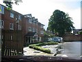
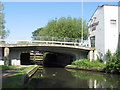
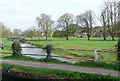
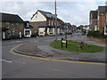
Photos of HP1 1UN


Area Information
Living in HP1 1UN means being part of a small, tightly knit residential cluster in England. With a population of 1,537, this area offers a quiet, community-focused environment. The postcode covers a compact area where daily life is shaped by proximity to local amenities and a stable demographic. Residents here are predominantly adults aged 30–64, reflecting a mature, established community. The area’s character is defined by its housing stock, which is largely composed of owner-occupied homes. While the cluster is small, it is well-connected to nearby towns and services, making it a practical choice for those seeking a balance between tranquillity and accessibility. The low crime risk and absence of environmental constraints like protected woodlands or wetlands contribute to a sense of security and ease of living. For those considering a move, HP1 1UN provides a snapshot of a traditional English neighbourhood with minimal modern disruptions, ideal for families or individuals looking for a settled lifestyle.
- Area Type
- Postcode
- Area Size
- Not available
- Population
- 1537
- Population Density
- 2835 people/km²
The property market in HP1 1UN is characterised by a high proportion of owner-occupied homes, with 59% of residents owning their properties. This suggests a stable and long-term housing market, where properties are less likely to be available for short-term rental. The accommodation type is primarily houses, which is typical for smaller postcode clusters where land is limited and housing development is constrained. This means the area is unlikely to have a significant rental market or a high turnover of properties. For buyers, this implies that the housing stock is relatively fixed, with limited new developments. The small size of the area also means that property values and availability are closely tied to the broader local market, particularly in nearby towns like Hemel Hempstead. Buyers should consider the limited scope for expansion and focus on the condition and location of individual properties within the cluster.
House Prices in HP1 1UN
No properties found in this postcode.
Energy Efficiency in HP1 1UN
The lifestyle in HP1 1UN is supported by nearby amenities that cater to daily needs. Within practical reach are retail options such as Tesco Hemel, M&S Hemel, and Iceland Hemel, providing access to groceries, clothing, and household goods. The area’s rail connectivity to Hemel Hempstead, Apsley, and Berkhamsted stations enhances mobility, allowing residents to access larger towns for additional shopping, dining, and leisure opportunities. While the immediate vicinity lacks detailed information on parks or recreational spaces, the proximity to rail and retail suggests a balance between local convenience and regional access. The presence of multiple railway stations also means residents can easily reach cultural or entertainment hubs in nearby towns. This combination of retail, transport, and connectivity contributes to a practical, accessible lifestyle for residents.
Amenities
Schools
Residents of HP1 1UN have access to a range of educational institutions, including Heath Lane Nursery School, which provides early years education. For primary schooling, South Hill Primary School is rated ‘good’ by Ofsted, offering a reliable option for families. The Hemel Hempstead School serves both primary and academy roles, indicating a mix of state and possibly specialist educational provision. The presence of both nursery and primary schools within the area ensures that families have options for early education and primary schooling without needing to travel far. The variety of school types may appeal to parents seeking different teaching approaches or curricula. However, the absence of secondary schools in the immediate vicinity means that students will need to attend institutions in nearby towns, which is common for smaller postcode areas.
| Rank | School | Type | Entry gender | Ages |
|---|
Explore more schools in this area
Go to Schools tabDemographics
The community in HP1 1UN is predominantly composed of adults aged 30–64, with a median age of 47. This suggests a mature population, likely with long-term ties to the area. Home ownership is strong, with 59% of residents owning their homes, indicating a stable housing market. The accommodation type is largely houses, which aligns with the area’s small, residential nature. The predominant ethnic group is White, reflecting a homogenous demographic profile. While no specific data on deprivation is provided, the high home ownership rate and low crime risk suggest a relatively affluent and secure environment. The absence of significant diversity metrics means the area’s social fabric is largely consistent with national averages for similar postcode clusters. This demographic profile may appeal to those seeking a predictable, low-traffic neighbourhood with established community networks.
Household Size
Accommodation Type
Tenure
Ethnic Group
Religion
Household Composition
Age
Household Deprivation
NS-SEC
Explore more demographic insights in this area
Go to Demographics tabPlanning
Planning Constraints
- Flood RiskPremium
- Ramsar Wetland SitesPremium
- Area of Outstanding Natural BeautyPremium
- Protected Nature ReservePremium
- Protected WoodlandPremium