Area Overview for HP1 1PF
Photos of HP1 1PF
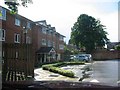
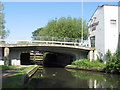
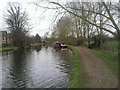
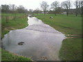
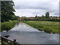

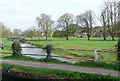
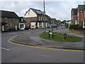
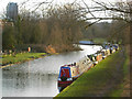
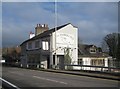
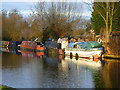

69 photos from this area
Area Information
Key information about the HP1 1PF including its size, population, and administrative classification.
- Area Type
- Postcode
- Area Size
- 2.5 hectares
- Population
- 1626
- Population Density
- 5693 people/km²
House Prices in HP1 1PF
40
Properties
£450,588
Average Sold Price
£103,000
Lowest Price
£1,075,000
Highest Price
Showing 40 properties
| Address | Type | Beds | Baths | Last Sale Price | Last Sale Date | |
|---|---|---|---|---|---|---|
| 79 Cowper Road, Hemel Hempstead, HP1 1PF | Terraced | 2 | 1 | £375,000 | Jan 2025 | |
| 115 Cowper Road, Hemel Hempstead, HP1 1PF | Detached | 5 | 2 | £1,075,000 | Dec 2024 | |
| 66A Cowper Road, Hemel Hempstead, HP1 1PF | Detached | 3 | 1 | £675,000 | Sep 2022 | |
| 72 Cowper Road, Hemel Hempstead, HP1 1PF | Detached | 4 | 3 | £760,000 | Aug 2022 | |
| 75 Cowper Road, Hemel Hempstead, HP1 1PF | house | 2 | - | £420,000 | Sep 2021 | |
| 63 Cowper Road, Hemel Hempstead, HP1 1PF | house | 2 | 1 | £380,000 | Jul 2021 | |
| 91 Cowper Road, Hemel Hempstead, HP1 1PF | house | - | - | £450,000 | Mar 2021 | |
| 73 Cowper Road, Hemel Hempstead, HP1 1PF | Detached | 3 | 3 | £500,000 | Oct 2020 | |
| 101 Cowper Road, Hemel Hempstead, HP1 1PF | Detached | 4 | 1 | £765,000 | Jun 2020 | |
| 95 Cowper Road, Hemel Hempstead, HP1 1PF | house | 3 | 1 | £380,000 | Jan 2020 |
Page 1 of 4
Energy Efficiency in HP1 1PF
Amenities
Schools
| Rank | School | Type | Entry gender | Ages |
|---|
Explore more schools in this area
Go to Schools tabDemographics
Household Size
Two person
most common
Accommodation Type
Houses
most common
Tenure
79
majority
Ethnic Group
White
most common
Religion
N/A
most common
Household Composition
N/A
most common
Age
47
median
Adults (30-64 years)
most common
Household Deprivation
N/A
with no deprivation
NS-SEC
53
in Lower managerial occupations
Explore more demographic insights in this area
Go to Demographics tabPlanning
Planning Constraints
- Flood RiskPremium
- Ramsar Wetland SitesPremium
- Area of Outstanding Natural BeautyPremium
- Protected Nature ReservePremium
- Protected WoodlandPremium