Area Overview for HP1 1HJ
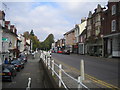
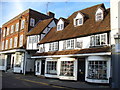
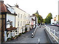
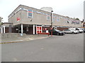
Photos of HP1 1HJ


Area Information
HP1 1HJ is a small, tightly knit residential postcode in England, home to 2080 residents. It sits within a cluster of properties, offering a compact living environment with practical access to nearby amenities. The area’s character is defined by its proximity to retail hubs and rail networks, making it convenient for commuters and shoppers. With a median age of 47, the community is predominantly composed of adults aged 30–64, suggesting a balance of established families and professionals. Daily life here is shaped by the availability of nearby supermarkets like Asda Hemel and Tesco Hemel, as well as multiple rail stations, including Hemel Hempstead and Kings Langley. The absence of natural constraints such as protected woodlands or AONB designations means development is unrestricted, though the area’s small size means residents often look to adjacent towns for broader services. For those seeking a quiet yet connected lifestyle, HP1 1HJ offers a blend of simplicity and accessibility, though its limited footprint requires careful consideration of nearby options.
- Area Type
- Postcode
- Area Size
- Not available
- Population
- Not available
- Population Density
- Not available
The property market in HP1 1HJ is characterised by a 48% home ownership rate, indicating that over half of residents rent their homes. This suggests a rental-focused market, likely influenced by the area’s small size and limited housing diversity. The predominant accommodation type is flats, which may reflect a demand for compact, manageable living spaces. For buyers, this means the local stock is unlikely to offer a wide range of property types, with flats being the primary option. The small postcode area’s constraints may push buyers to consider nearby towns for larger homes or alternative housing styles. However, the presence of rail stations within practical reach could enhance the area’s appeal for commuters seeking affordable, centrally located flats. Potential buyers should note that the market’s limited scale may require flexibility in location or property type.
House Prices in HP1 1HJ
No properties found in this postcode.
Energy Efficiency in HP1 1HJ
Living in HP1 1HJ offers access to essential amenities within practical reach. The area is served by five retail outlets, including Asda Hemel, Iceland Hemel, and Tesco Hemel, ensuring everyday shopping needs are met without long trips. Rail connectivity is a key feature, with five nearby stations—Hemel Hempstead, Apsley, and Kings Langley—facilitating easy travel to surrounding towns and cities. While the area itself is small, the proximity to larger retail and transport hubs enhances convenience. The absence of major parks or leisure facilities within HP1 1HJ means residents may need to venture to nearby towns for recreational activities. Nonetheless, the combination of retail access and rail links creates a functional lifestyle, ideal for those prioritising practicality over expansive amenities.
Amenities
Schools
| Rank | School | Type | Entry gender | Ages |
|---|
Explore more schools in this area
Go to Schools tabDemographics
The population of HP1 1HJ is 2080, with a median age of 47. The majority of residents fall within the 30–64 age range, indicating a community of working-age adults and older professionals. Home ownership is relatively low at 48%, suggesting a significant proportion of residents rent their homes. The predominant accommodation type is flats, reflecting a housing stock tailored to smaller households or couples. The dominant ethnic group is White, with no specific data provided on other demographics. While 48% ownership implies a mix of long-term residents and renters, the absence of detailed diversity statistics means the full composition of the community remains partially unexplored. The area’s age profile and housing type suggest a pragmatic, functional living environment, though the lack of data on deprivation or income levels means quality of life factors remain unspecified.
Household Size
Accommodation Type
Tenure
Ethnic Group
Religion
Household Composition
Age
Household Deprivation
NS-SEC
Explore more demographic insights in this area
Go to Demographics tabPlanning
Planning Constraints
- Flood RiskPremium
- Ramsar Wetland SitesPremium
- Area of Outstanding Natural BeautyPremium
- Protected Nature ReservePremium
- Protected WoodlandPremium