Area Overview for Hoxne & Worlingworth Ward
Photos of Hoxne & Worlingworth Ward

Area Information
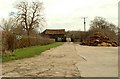
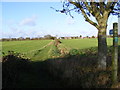
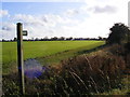
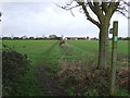
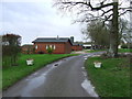
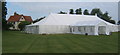
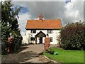
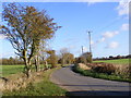
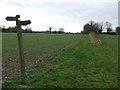
Living in Hoxne & Worlingworth Ward means settling into a rural district that covers 54.5 km² within Suffolk, England. This ward offers a distinctly quiet existence away from the crowds of larger towns. You will find a community defined by space and tranquility rather than urban density. The area houses a demographic that leans heavily towards retirement or established families, creating a settled pace of daily life. There are no large commercial hubs within the ward boundaries, so your daily routine will centre on local village amenities rather than city centres. You should expect a lifestyle centred on the natural environment, given the significant green spaces present in the ward. The housing stock is predominantly owned by those who live there, suggesting a stable and long-term community fabric. While the drive into the ward is surrounded by low-rise structures and open countryside, you will not find the infrastructure of a major metropolitan centre. Instead, this area provides a snapshot of traditional English village living. Prospective buyers looking for homes in Hoxne & Worlingworth Ward can expect properties that reflect the local vernacular and a lifestyle that prioritises peace over convenience. The district unitary ward structure ensures local governance is tailored to these specific rural needs.
- Area Type
- District Borough Unitary Ward
- Area Size
- 54.5 km²
- Population
- Not available
- Population Density
- Not available
Demographics
The community in Hoxne & Worlingworth Ward is defined by an older population profile. The median age stands at 70 years, indicating that the most common age range falls squarely within retirement years. You will not find a youthful demographic driving the local culture or schools; instead, the social fabric is woven around the needs and rhythms of seniors. Home ownership is the dominant force here, with 78% of households owning their property outright or with a mortgage. This high rate of ownership contrasts sharply with the rental markets found in major English cities. The level of home ownership suggests residents have chosen to settle permanently in this ward rather than passing through for a short stay. Accommodation types reflect this stability, with the majority of properties being owner-occupied homes. The ward does not show significant diversity metrics in the available data, pointing towards a relatively homogenous community. There is no indication of large-scale migration or transient populations. This demographic profile shapes the local shops, services, and community groups to cater to an older audience. If you are considering homes in Hoxne & Worlingworth Ward, you are entering a market where neighbours are likely permanent residents who have lived for decades.
Household Size
Accommodation Type
Tenure
Ethnic Group
Religion
Household Composition
Age
Household Deprivation
NS-SEC
Explore more demographic insights in this area
Go to Demographics tabPlanning
Planning Constraints
- Flood RiskPremium
- Ramsar Wetland SitesPremium
- Area of Outstanding Natural BeautyPremium
- Protected Nature ReservePremium
- Protected WoodlandPremium
- Crime RiskPremium