Area Overview for Howe Green
Photos of Howe Green


Area Information
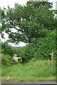
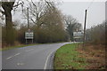
Living in Howe Green offers a distinct experience within a built-up area in England covering 54.6 hectares. This territory functions primarily as a residential zone where daily life revolves around a specific community dynamic. The land use classification indicates a settled town environment rather than an open rural landscape. You will find yourself in an established setting where the fabric of the neighbourhood is solid and defined. While the area does not boast vast square mileage, the concentration of homes creates a tight-knit feel suitable for those seeking proximity to services. The character of the place suggests a focus on domestic life rather than industrial or commercial expansion. Prospective buyers should understand that Howe Green is a self-contained pocket of the wider Chelmsford region. The proximity to major transport hubs means you remain connected to the city without being overwhelmed by urban density. Your routine will likely involve commuting via nearby rail links or visiting local shops for essentials. The scale of the area limits large-scale developments, preserving a sense of local identity. When you choose to live in Howe Green, you are selecting a location where practicality meets relative calm. The 54.6 hectare footprint supports a manageable population that benefits from established local facilities.
- Area Type
- Built Up Area 250
- Area Size
- 54.6 hectares
- Population
- Not available
- Population Density
- Not available
Residents of Howe Green enjoy immediate access to a diverse range of shopping and transport hubs within a practical driving distance. Five major retail outlets are located very close by, including Co-op Great, Morrisons Daily Great, and Tesco Great. These stores provide everything from fresh groceries to household essentials, allowing you to complete your weekly shop without travelling far. Beyond shopping, the area boasts excellent rail connectivity with five stations within reach. Chelmsford Railway Station, South Woodham Ferrers Railway Station, and Battlesbridge Railway Station sit near enough to integrate seamlessly into your commute. These stations offer frequent services that link you to Greater London and the wider East of England region. The combination of nearby supermarkets and rapid rail links creates a lifestyle defined by convenience and efficiency. You do not need a extensive social life to feel satisfied in this location. The presence of multiple grocery chains ensures competitive pricing and varying store formats. Whether you prefer large hypermarts or smaller daily shops, the options available nearby cater to every preference. Your time outside the home is spent engaging with a well-serviced environment.
Amenities
Schools
| Rank | School | Type | Entry gender | Ages |
|---|
Explore more schools in this area
Go to Schools tabDemographics
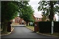
The community in Howe Green is defined by a mature demographic structure with a median age of 70 years. Residents are heavily concentrated in the older age brackets, distinguishing this neighbourhood from younger urban districts. This population profile suggests an area dominated by retirees, empty nesters, and long-term residents who have settled into their homes. Home ownership stands at a remarkable 85%, indicating that the vast majority of households live in properties they have purchased or inherited. The high proportion of owner-occupiers points to stability within the residential fabric of Howe Green. Accommodation types reflect this tenure status, with few private rentals present in the mix. The household composition aligns with an older demographic, often featuring singles or couples living in static residences. You will encounter very few shared households or young families raising children in this specific postcode. The ethnic makeup and religious adherence follow the general pattern of established older communities without significant recent diversification. Deprivation metrics suggest this area maintains a higher standard of living correlating with the stable ownership rates. Beneath these statistics lies a community where residents know one another and take collective ownership of their local environment.
Household Size
Accommodation Type
Tenure
Ethnic Group
Religion
Household Composition
Age
Household Deprivation
NS-SEC
Explore more demographic insights in this area
Go to Demographics tabPlanning
Planning Constraints
- Crime RiskPremium