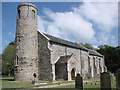
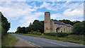
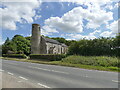
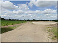
Area Overview for Hoveton & Tunstead Ward
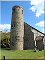
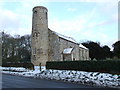
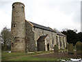
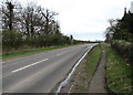
Photos of Hoveton & Tunstead Ward

Area Information
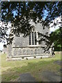
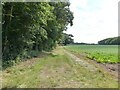
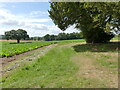
Living in Hoveton & Tunstead Ward offers a distinctly rural experience within Norfolk, England. This district borough unitary ward covers a significant expanse of 59.5 km², presenting a landscape where open space dominates the daily view. The area is defined by its connection to the wider countryside rather than urban density. Residents here navigate a community shaped by these physical boundaries, where the distance between homes often reflects the broad land area available. You will find that daily life revolves around the specific character of this ward, away from the immediate pace of larger towns. The sense of place is rooted in its geography, making it a unique choice for those seeking room and quiet. Understanding the scale of this 59.5 km² region helps you appreciate the isolation and the freedom it brings. There are no high-rise blocks here; instead, the housing stock fits into the broader pattern of the surrounding farmland and estates. This makes Hoveton & Tunstead Ward a clear option for buyers who prioritise space over city conveniences. The location requires you to plan transport and leisure activities carefully, given the vast distances involved. Yet, the reward is a settled pace of life that many find essential in their search for homes in this part of Norfolk.
- Area Type
- District Borough Unitary Ward
- Area Size
- 59.5 km²
- Population
- Not available
- Population Density
- Not available
Demographics
The community within Hoveton & Tunstead Ward displays a clear demographic skew towards older residents. The median age stands at 70 years, indicating that the population is significantly older than the national average for England. Most commonly, the age distribution falls into the "Total" category, which reflects the broad spread of the population without a young working age cohort dominating the scene. You are entering an area where retirement and semi-retirement likely define the social fabric. Home ownership is entrenched as the primary mode of living, with 75% of households owning their property outright or with a mortgage. This high rate suggests long-term stability and resident investment in the local neighbourhood. With three-quarters of homes being owner-occupied, the rental market exists but does not drive the housing dynamics. The area lacks significant data on specific ethnic groups and predominant ethnicities in the provided records, meaning the community composition relies on these typical English rural demographics without specific statistical outliers highlighted. For those looking at schools near Hoveton & Tunstead Ward, the age profile suggests fewer young families currently filling those local institutions compared to urban centres.
Household Size
Accommodation Type
Tenure
Ethnic Group
Religion
Household Composition
Age
Household Deprivation
NS-SEC
Explore more demographic insights in this area
Go to Demographics tabPlanning
Planning Constraints
- Flood RiskPremium
- Ramsar Wetland SitesPremium
- Area of Outstanding Natural BeautyPremium
- Protected Nature ReservePremium
- Protected WoodlandPremium
- Crime RiskPremium