Area Overview for Houghton Regis West Ward
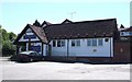
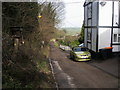
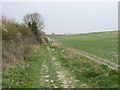
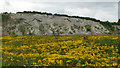
Photos of Houghton Regis West Ward

Area Information
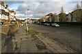
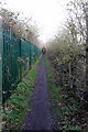
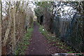
Houghton Regis West Ward sits within the town and civil parish of Houghton Regis in Central Bedfordshire. This district borough unitary ward covers a dense 8.0 km² area, located just south of Luton and Dunstable. The name Houghton derives from Saxon words meaning village on the spur of a hill, a history dating back to the 11th century when it became known as King's Houghton. Originally a small village, the area transformed during a major development phase in the 1950s and 1960s as part of a London overspill estate. You will find remnants of this past history in street names like Tithe Farm Road. Today, the ward forms part of the larger Luton and Dunstable urban conurbation, bordering the Chiltern Hills and neighbouring Dunstable to the south. The geography is defined by major road corridors, including the A5505 Woodside Link Connects the estate to the M1 motorway at Junction 11a. The Icknield Way Path runs through the parish, offering routes for walkers, horse riders, and cyclists. This location places you within a settlement with a population supporting a conurbation of over 286,000 people. Living in Houghton Regis West Ward means being embedded in a region that balances historical roots with contemporary urban expansion, including planned extensions for thousands of new homes and employment land.
- Area Type
- District Borough Unitary Ward
- Area Size
- 8.0 km²
- Population
- Not available
- Population Density
- Not available
Demographics
The community in Houghton Regis West Ward features a distinct age profile with a median age of 70 years. You are likely to find that the area attracts an older demographic compared to the national average. Age breakdown data indicates a significant presence across all age ranges, contributing to this elevated median. Within this community, 66% of residents own their homes, reflecting a settled population with strong attachment to the area. The remaining household composition suggests a mix of tenanted properties and shared arrangements typical of a mature estate. Accommodation types in the ward reflect years of council-led housing development, forming the backbone of the local stock. The predominant ethnic group, religion, and specific household composition details highlight the general make-up of those calling this part of Central Bedfordshire home. Houghton Regis West Ward does not rely on transient populations but rather maintains a stable social fabric. When considering homes in Houghton Regis West Ward, you should expect a quieter environment suited to older residents seeking independence. The high home ownership rate signals that many families moved here decades ago and have stayed through the decades, creating a neighbourhood with deep historical roots rather than the turnover often found in new-build estates.
Household Size
Accommodation Type
Tenure
Ethnic Group
Religion
Household Composition
Age
Household Deprivation
NS-SEC
Explore more demographic insights in this area
Go to Demographics tabPlanning
Planning Constraints
- Flood RiskPremium
- Ramsar Wetland SitesPremium
- Area of Outstanding Natural BeautyPremium
- Protected Nature ReservePremium
- Protected WoodlandPremium
- Crime RiskPremium