Area Overview for Horringer
Photos of Horringer


Area Information
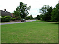
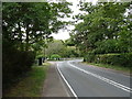
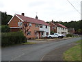
Living in Horringer offers a compact, well-defined community within a 36.6-hectare built-up area. The area’s demographic profile is distinct, with a median age of 70, suggesting a mature population. This is reflected in the high home ownership rate of 80%, indicating a stable, long-term resident base. Daily life in Horringer is shaped by its proximity to essential services, including retail outlets like M&S West and Tesco Bury St, and rail links to Bury St Edmunds and Thurston stations. The area’s low crime risk score of 82 adds to its appeal, offering a sense of security. While Horringer is small, its mix of retail, transport, and educational facilities creates a self-contained environment. For those seeking a quiet, established neighbourhood with practical amenities, Horringer provides a balance of convenience and community. The presence of Ickworth Park Primary School nearby further supports families, though the area’s character leans toward a more mature demographic.
- Area Type
- Built Up Area 250
- Area Size
- 36.6 hectares
- Population
- Not available
- Population Density
- Not available
Residents of Horringer have access to a range of amenities within practical reach. Retail options include M&S West, Tesco Bury St, and Aldi Bury, providing convenience for shopping and daily essentials. The area’s rail stations—Entrance, Bury St Edmunds, and Thurston—offer easy access to nearby towns and transport hubs. While the data does not specify parks or leisure facilities, the presence of Ickworth Park Primary School suggests some green space is nearby. The compact size of the area means amenities are closely clustered, reducing the need for long commutes. The mix of retail and transport options creates a functional lifestyle, though the absence of detailed information on leisure facilities leaves room for further exploration.
Amenities
Schools
The nearest school to Horringer is Ickworth Park Primary School, which serves the local community. The data lists this school twice, but it remains the sole primary school in the area. As a primary school, it caters to younger families, though no Ofsted ratings are provided to assess its quality. The absence of secondary schools nearby means families may need to consider commuting for higher education. The single primary school suggests a limited range of educational options, which could be a factor for parents prioritising a variety of school types. For those seeking a primary school within walking distance, Ickworth Park Primary School is the primary choice, but further research into secondary education options would be necessary.
| Rank | A + A* % | School | Type | Entry gender | Ages |
|---|---|---|---|---|---|
| 1 | N/A | Ickworth Park Primary School | primary | N/A | N/A |
| 2 | N/A | Ickworth Park Primary School | primary | N/A | N/A |
Explore more schools in this area
Go to Schools tabDemographics
Horringer’s population has a median age of 70, with the most common age range encompassing all ages. This suggests a community dominated by older residents, which may influence local services and social dynamics. Home ownership is high, at 80%, indicating a strong presence of long-term residents rather than transient renters. The data does not specify household composition or accommodation types, but the overall profile implies a settled population. With no detailed information on diversity or deprivation, the area’s social fabric remains largely defined by age and tenure. The lack of specific figures on ethnicity or religion means broader demographic trends are not quantified here. For buyers, this could mean a neighbourhood with established infrastructure but potentially limited demand for newer housing developments.
Household Size
Accommodation Type
Tenure
Ethnic Group
Religion
Household Composition
Age
Household Deprivation
NS-SEC
Explore more demographic insights in this area
Go to Demographics tabPlanning
Planning Constraints
- Crime RiskLocked