Area Overview for Holverston
Photos of Holverston


Area Information
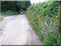
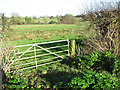
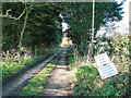
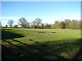
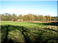
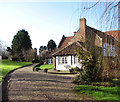
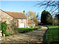
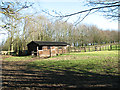
Holverston is a small civil parish located in England, covering an area of just 1.4 square kilometres. This compact size defines the character of daily life for those living in Holverston, where the community is close-knit and distances are short. The area offers a quiet environment suitable for residents who prefer a rural or semi-rural setting without the chaos of major urban centres. You will find that living in Holverston means relying on a well-established local infrastructure rather than extensive public transport networks. The parish provides a distinct lifestyle where every location within the parish boundaries feels accessible and manageable. The neighbourhood develops a strong sense of identity because the physical boundaries are so clearly defined and small. You can walk or cycle throughout most of the area, making it ideal for pedestrians and those without access to a car. The focus here is on simplicity and stability, as the limited land area restricts rapid development. Prospective buyers looking for homes in Holverston should expect a traditional village atmosphere where the pace of life is deliberately slow. The area functions best as a bedroom community or a quiet retirement location, depending on the specific needs of the household. Everything you need for daily living is contained within this compact geographical footprint.
- Area Type
- Parish
- Area Size
- 1.4 km²
- Population
- Not available
- Population Density
- Not available
Demographics
The community in Holverston reflects a mature demographic profile, with the median age sitting at 70 years old. This high average indicates that the area attracts older residents who have established their careers elsewhere or are retiring from urban life. People living in Holverston are likely to be looking for peace and stability rather than nightlife or rapid career progression. The age structure suggests a population that has moved out of the general workforce and into a phase of life prioritising comfort and local amenities suited to older adults. Home ownership stands at an impressive 79% within the parish, which significantly influences the social fabric. This high rate suggests that the majority of households have built their equity over time and are settled rather than transient. Most families living in Holverston have stayed for decades, creating a stable environment away from the turnover common in rental markets. The demographic data shows that typical households consist of individuals or couples who have made long-term commitments to the area. There is no indication of significant ethnic diversification or religious heterogeneity in the current statistics, pointing towards a traditionally homogenous community. You will find that living in Holverston involves navigating a society where long-standing traditions and neighbourly bonds are the norm. The lack of young families or transient workers contributes to a quieter atmosphere, though this may present challenges if you require amenities targeted at children or younger professionals. The spreadsheet confirms a singular focus on stability over rapid change.
Household Size
Accommodation Type
Tenure
Ethnic Group
Religion
Household Composition
Age
Household Deprivation
NS-SEC
Explore more demographic insights in this area
Go to Demographics tabPlanning
Planning Constraints
- Flood RiskPremium
- Ramsar Wetland SitesPremium
- Area of Outstanding Natural BeautyPremium
- Protected Nature ReservePremium
- Protected WoodlandPremium
- Crime RiskPremium