Area Overview for Hoe and Worthing
Photos of Hoe and Worthing


Area Information
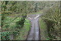
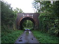
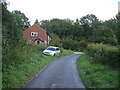
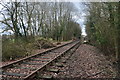
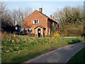
Hoe and Worthing is a small civil parish covering 9.3 km² in England. You will find a distinctive community where daily life moves at a deliberate pace. The area is defined by its compact size and clear demographic identity. Residents enjoy a setting where the physical environment remains largely unconstrained by major planning designations. There are no Ramsar wetland sites, Areas of Outstanding Natural Beauty, or protected woodland boundaries limiting development within the parish. This regulatory status does, however, sit alongside significant environmental advantages. Flood risk remains low, ensuring stability for those considering homes in Hoe and Worthing. The community feels safe, with crime rates falling below the national average. You can expect a quiet neighbourhood where the primary concerns revolve around personal well-being rather than property anxieties. Living here means choosing a location where safety scores are high and environmental hazards are minimal. The area represents a specific slice of coastal or semi-rural England where ownership is the norm. Prospective buyers often seek this stability when they research living in Hoe and Worthing. The combination of low risk and established community ties makes this parish a practical choice for those prioritising security and tranquility.
- Area Type
- Parish
- Area Size
- 9.3 km²
- Population
- Not available
- Population Density
- Not available
Demographics
The community in Hoe and Worthing reflects a distinct lifestyle demographic. Data indicates that the median age is 70 years old. This figure places the population firmly in a retirement or elderly phase of life. Families with young children are less likely to be found residing in the parish compared to other UK areas. Home ownership stands at 69%, which remains a substantial majority. This high rate suggests that long-term residents have settled into their properties for many years. The household composition follows this older profile, with fewer new families moving into the area each year. Accommodation types align with this ownership culture, prioritising stability over transient living arrangements. You will not find a diverse mix of ethnic groups or religious denominations prominently featured in the official statistics for this specific parish. The social fabric is built around shared history and established relationships. Those looking at homes in Hoe and Worthing should expect a settled population rather than a cosmopolitan mix. The age profile means that local services cater primarily to older adults. Understanding these demographics helps you gauge the community feel before visiting. The data paints a picture of a quiet, owner-occupied zone rather than a bustling hub of young professionals or families.
Household Size
Accommodation Type
Tenure
Ethnic Group
Religion
Household Composition
Age
Household Deprivation
NS-SEC
Explore more demographic insights in this area
Go to Demographics tabPlanning
Planning Constraints
- Flood RiskPremium
- Ramsar Wetland SitesPremium
- Area of Outstanding Natural BeautyPremium
- Protected WoodlandPremium
- Crime RiskPremium