Area Overview for Highwoods Ward
Photos of Highwoods Ward

Area Information
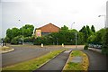
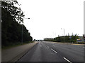
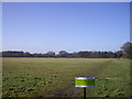
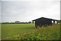
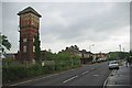
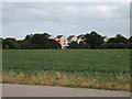
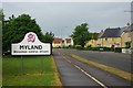
Living in Highwoods Ward offers a distinct suburban experience north of Colchester's town centre. This ward spans 3.6 square kilometres and serves a population of 3,178 residents. The area sits within the Colchester parliamentary constituency, providing clear local political representation. You will find yourself surrounded by established housing developments and local businesses rather than dense urban sprawl. High Woods Country Park defines the character of the neighbourhood, providing extensive green space that contrasts with the busy roads bordering the estate. The visitor centre on Turner Road offers facilities within this 150-hectare reserve, which expanded significantly in 2000. The boundary between Highwoods and the Mile End ward runs along a stream inside the park, delineating this specific district. As a suburban enclave, Highwoods balances residential peace with proximity to the main railway station, ensuring decent access to wider travel networks. Walking to the park offers a daily retreat, while the ward's established layout suggests a community focused on settled living rather than rapid change.
- Area Type
- District Borough Unitary Ward
- Area Size
- 3.6 km²
- Population
- 3178
- Population Density
- 885 people/km²
Demographics
The community in Highwoods Ward reflects a mature and established population. The median age stands at 70 years, indicating a largely older demographic where long-term residents have settled over many years. This profile suggests a neighbourhood dominated by retirees or older families who prefer the stability of suburban life. Home ownership is the prevailing mode of tenure, with 59% of households owning their properties outright or with a mortgage. A significant portion of residents therefore possess financial independence from rental market fluctuations. The ward functions as a predominantly owner-occupied community, fostering a sense of investment in the local estate. Accommodation types and household compositions align with this demographic reality, showcasing traditional family homes rather than high-density rentals. The area lacks the transient feel often found in university towns or student hubs. Instead, you encounter long-term inhabitants who know every street and local coffee shop. This stability contributes to a quiet, predictable environment where neighbours likely have lived for decades.
Household Size
Accommodation Type
Tenure
Ethnic Group
Religion
Household Composition
Age
Household Deprivation
NS-SEC
Explore more demographic insights in this area
Go to Demographics tabPlanning
Planning Constraints
- Flood RiskPremium
- Ramsar Wetland SitesPremium
- Area of Outstanding Natural BeautyPremium
- Protected Nature ReservePremium
- Protected WoodlandPremium
- Crime RiskPremium