Area Overview for High Town Ward
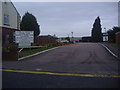
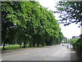
Photos of High Town Ward

Area Information
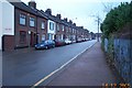
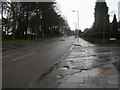
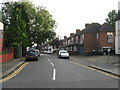
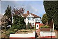
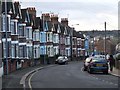
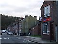
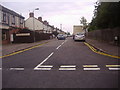
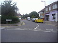
Living in High Town Ward offers immediate proximity to Luton railway station, a key feature for commuters and visitors alike. This inner urban district covers just 1.5 km² within the Borough of Luton, creating a compact environment where daily needs are often within walking distance. You will find the area defined by Victorian-era terraced housing, small workshops, and local chapels that reflect its nineteenth-century origins. Development began around 1841 when Frederick Burr sold fields along the route that became High Town Road, with rapid growth spurred by the 1858 arrival of the railway from Dunstable. By 1922, the estate had expanded to include housing up to Hitchin Road, iron foundries, dye works, and a cottage hospital. Today, the distinctive character of High Town relies on its historic shopping centre along High Town Road, which serves local residents and workers. Key landmarks include St Matthew's School on Havelock Road and the Methodist Chapel also on High Town Road. The area retains a historical suburban feel despite its inner-city location, supported by excellent footbridge access to Luton town centre. Your daily life here involves navigating a mix of residential streets like Burr Street, Duke Street, Wenlock Street, and Havelock Road, all centred around the transport hub at the railway station.
- Area Type
- District Borough Unitary Ward
- Area Size
- 1.5 km²
- Population
- Not available
- Population Density
- Not available
Demographics
The community in High Town Ward is predominantly elderly, with a median age of 70 years across the total population. This significant age profile suggests an area where senior residents form the core of the demographic structure. Regarding housing tenure, 35% of homes in High Town Ward are owner-occupied, meaning the majority of residents currently rent their properties. While specific data on household composition, predominant ethnic groups, religion, and total accommodation types are not detailed in the available records, the age concentration highlights a specific life stage for the majority of neighbours. This high median age often correlates with a quieter street life and a community reliant on local services tailored to older adults. The low percentage of owner-occupiers indicates that investing in a home here may involve purchasing within the private renting sector rather than buying a freehold property directly. For those considering moving to High Town Ward, the demographic picture points to a stable but ageing population where local amenities and transport links are critical for maintaining independence. The area does not show characteristics typical of young professional hubs or high-mobility rental markets.
Household Size
Accommodation Type
Tenure
Ethnic Group
Religion
Household Composition
Age
Household Deprivation
NS-SEC
Explore more demographic insights in this area
Go to Demographics tabPlanning
Planning Constraints
- Flood RiskPremium
- Ramsar Wetland SitesPremium
- Area of Outstanding Natural BeautyPremium
- Protected Nature ReservePremium
- Protected WoodlandPremium
- Crime RiskPremium