Area Overview for High Roothing
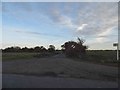
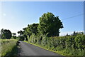
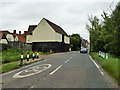
Photos of High Roothing
Area Information
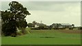
High Rooting is a civil parish spanning 8.0 km² in England, offering a compact yet distinct living environment for those seeking a quieter lifestyle. The area represents a specific type of rural settlement where residents enjoy a lower population density compared to urban centres. Daily life here revolves around a pace that is slower than the city, with a focus on local community interactions rather than high-speed transit. The parish structure means you are part of a defined administrative unit with its own history and governance, separate from larger neighbouring towns. You are entering a space where the scale of development is modest, and the focus remains on established character rather than rapid expansion. This setting suits individuals who prioritise space and tranquility over proximity to major city hubs. The size of the parish allows for a sense of independence while still maintaining the practicalities of rural living. You are choosing an address where the immediate surroundings are rural, and the community operates on traditional lines. The location is defined by its boundaries and its distance from larger employment centres.
- Area Type
- Parish
- Area Size
- 8.0 km²
- Population
- Not available
- Population Density
- Not available
Demographics
The community in High Roothing is notably older, with a demographic profile that skews towards retirement-age residents. The median age is 70, indicating that the majority of households are likely retirees or older couples. This age distribution shapes the local culture, fostering a quiet atmosphere where intergenerational interaction is less common and community activities cater to mature interests. The total population is dominated by this age cohort, meaning you will encounter few families with young children compared to busier suburban parishes. Home ownership is prevalent, standing at 73%, which suggests that most long-term residents have settled in the area over many years. This high level of ownership creates a stable community led by people with vested interests in the local neighbourhood. The diversity of the population, measured by predominant ethnic groups and religious affiliations, forms the complete demographic picture of the parish. With most residents tied to the area through ownership and age, there is a strong sense of continuity among neighbours.
Household Size
Accommodation Type
Tenure
Ethnic Group
Religion
Household Composition
Age
Household Deprivation
NS-SEC
Explore more demographic insights in this area
Go to Demographics tabPlanning
Planning Constraints
- Flood RiskPremium
- Ramsar Wetland SitesPremium
- Area of Outstanding Natural BeautyPremium
- Protected Nature ReservePremium
- Protected WoodlandPremium