Area Overview for High Ongar
Photos of High Ongar
Area Information
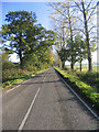
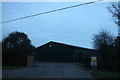
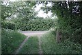
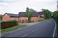
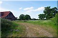
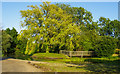
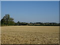
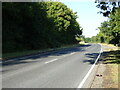
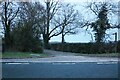
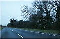
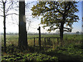
High Ongar stands as a historic civil parish within the Epping Forest district of Essex, covering an area of 15.9 square kilometres with a population of approximately 2,464. This location sits near the coordinates 51.698698, 0.300787, placing it at postcode CM4 0NA within the Eastern Region of England. The parish represents a distinct rural settlement from which the planted market town of Chipping Ongar was historically carved out. Residents here enjoy a setting defined by deep history rather than modern urban sprawl. First mentioned in the Domesday Book of 1086, High Ongar traces its roots back to a possession of Eustace, Count of Boulogne, within the Ongar Hundred. St Mary's Church anchors the community with a nave dating from the 12th century, while local legend connects the name to Henry VIII stopping en route for Jericho Priory around 1536. You will find yourself surrounded by heritage sites, including the Nine Ashes pub and memorials to the Stane family landowners within the parish registers dating back to 1538. Living in High Ongar means embracing a village life where the past remains immediately visible. The area offers a quiet existence far from the city centre, situated along the border of the ancient woodland of Epping Forest. You can explore the parish without navigating through congested town centres, benefiting from a layout that prioritises rural peace over commercial bustle.
- Area Type
- Parish
- Area Size
- 15.9 km²
- Population
- Not available
- Population Density
- Not available
Demographics
The population of High Ongar reflects a community dominated by older residents. The median age is exactly 70 years, indicating a settlement heavily populated by seniors. The most common age range listed in the data covers the total population, confirming no younger demographic peaks. This age profile often suggests a retirement destination or a quiet village where families with young children play a secondary role. Home ownership in the parish stands at 74%, creating a stable, owner-occupied community. Such high ownership rates usually mean residents have long-term ties to their addresses and are less likely to move frequently. The data classifies household composition and accommodation types as totals, implying a mix of traditional housing structures suited to this rural context rather than modern high-density blocks. Ethnic diversity data is not explicitly detailed in the raw figures, but the historical roots suggest a traditionally homogenous population. Religious data is similarly presented as a total category. When you consider living in High Ongar, you are joining a settled group where property values tend to remain steady due to the lack of speculative turnover. The village does not experience the volatility of a student or commuter boom town. Instead, the demographic makeup supports a slower pace of life where local services cater primarily to older needs and established residents.
Household Size
Accommodation Type
Tenure
Ethnic Group
Religion
Household Composition
Age
Household Deprivation
NS-SEC
Explore more demographic insights in this area
Go to Demographics tabPlanning
Planning Constraints
- Flood RiskPremium
- Ramsar Wetland SitesPremium
- Area of Outstanding Natural BeautyPremium
- Protected Nature ReservePremium
- Protected WoodlandPremium
- Crime RiskPremium