Area Overview for High Laver
Photos of High Laver
Area Information
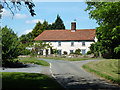
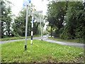
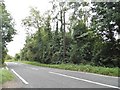
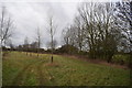
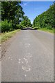
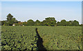
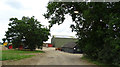
High Laver is a small village and civil parish located in the Epping Forest district of Essex. You will find it covers an area of 7.3 km², situated approximately four miles northwest of Ongar and 4.5 miles southeast of Harlow. This parish sits at grid reference TL526087, placing it near junction 7 of the M11 motorway. The location offers reasonable access to major transport links while maintaining a rural character. Recorded in the Domesday Book of 1086, the area historically consisted of 1428 acres of arable land and woodland capable of supporting 200 pigs. Most men were employed in farming per the 1881 census, establishing a long agricultural tradition. Daily life in High Laver is shaped by its connection to history and its quiet village setting. The manor of Otes was purchased around 1614 by William Masham, linking the parish to a notable literary past. John Locke lived there as a guest of Sir Francis Masham from 1691 until his death in 1704, when he was buried in All Saints' Churchyard alongside Abigail Masham, Baroness Masham. You can see this heritage preserved in the church, which features a 14th-century octagonal font and a brick altar tomb for John Locke rebuilt in 1932. For those considering homes in High Laver, the combination of historical significance and proximity to Harlow and Ongar defines the residential experience. Living in High Laver means balancing a peaceful rural environment with practical accessibility to the wider region. The parish remains a distinct community without being isolated from modern infrastructure.
- Area Type
- Parish
- Area Size
- 7.3 km²
- Population
- Not available
- Population Density
- Not available
Demographics
The community in High Laver has a clear demographic profile defined by an older population and high home ownership rates. The median age for residents is 70, indicating that the village serves as a destination for older adults. Most common age ranges reflect this mature demographic structure rather than families with young children. Home ownership stands at 76%, which is significantly higher than the national average. This figure suggests that most residents bought their properties outright or have long-term tenure agreements. You will find that household composition and accommodation types align with a settled, owner-occupied population. The area does not have a large student population or transient workforce driving the economy. Instead, the housing stock likely consists of established homes maintained by those who value permanence. There is no data on specific ethnic breakdowns or religious affiliations in the provided records, so you cannot assume a diverse demographic mix based on numerical evidence. The low crime risk score of 86 out of 100 indicates that safety is not a concern for residents. This high safety rating reflects below-average crime rates for the neighbourhood. Deprivation levels are not explicitly detailed in the available statistics, but the high proportion of owner-occupied homes often correlates with financial stability. For anyone researching living in High Laver, the primary demographic fact is the age concentration. If you are looking at schools near High Laver, you should expect them to cater to this older community's needs, though specific school catchment data requires further checking outside this report. The 76% ownership rate creates a stable environment where property values rely on long-term investment rather than short-term rental yields.
Household Size
Accommodation Type
Tenure
Ethnic Group
Religion
Household Composition
Age
Household Deprivation
NS-SEC
Explore more demographic insights in this area
Go to Demographics tabPlanning
Planning Constraints
- Flood RiskPremium
- Ramsar Wetland SitesPremium
- Area of Outstanding Natural BeautyPremium
- Protected Nature ReservePremium
- Protected WoodlandPremium
- Crime RiskPremium