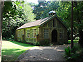
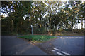
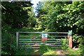
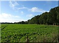
Area Overview for High Kelling
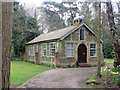
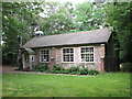
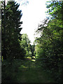
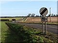
Photos of High Kelling
Area Information
High Kelling is a compact built-up area spanning 59.9 hectares, nestled in the heart of England. Its character is shaped by a population with a median age of 70, suggesting a community skewed towards older residents. This demographic profile influences the area’s pace of life, with a focus on stability and established living. The 70% home ownership rate indicates a strong presence of long-term residents, many of whom may have lived in the area for decades. Proximity to nearby towns like Holt and Weybourne adds to its appeal, offering access to amenities without the need for long commutes. The area’s small size means that essential services and transport links are within practical reach, creating a self-contained environment. For those considering living in High Kelling, the combination of a mature population, reliable rail connections, and nearby retail hubs makes it a practical choice for those prioritising convenience and a slower, community-oriented lifestyle.
- Area Type
- Built Up Area 250
- Area Size
- 59.9 hectares
- Population
- Not available
- Population Density
- Not available
Living in High Kelling offers access to a range of nearby amenities, including two metro areas—Holt and Weybourne—each providing distinct services and character. Retail options are plentiful, with Morrisons Daily, Budgens in Holt, and Budgens in Sheringham offering daily essentials. These shops cater to both routine needs and casual shopping, ensuring convenience for residents. The two railway stations—Sheringham and West Runton—further enhance connectivity, allowing easy travel to larger towns or cities. The area’s proximity to these hubs means that residents can enjoy a balance between a quiet, localised lifestyle and access to broader opportunities. Whether it’s a trip to the supermarket or a train ride to a nearby destination, High Kelling’s amenities support a practical, community-focused way of life.
Amenities
Schools
| Rank | A + A* % | School | Type | Entry gender | Ages |
|---|
Explore more schools in this area
Go to Schools tabDemographics
High Kelling’s population has a median age of 70, the highest in the dataset, indicating a community predominantly composed of older adults. This age profile suggests a demographic that may prioritise stability, with 70% of homes owned outright by residents. The data does not specify household composition or accommodation types, but the high home ownership rate implies a mix of family homes and properties occupied by single individuals or couples. The absence of detailed diversity metrics means the area’s cultural and ethnic composition remains unquantified, though the provided data does not highlight any specific challenges or advantages in this regard. The older age group may influence local services and amenities, with a focus on healthcare and community support. For buyers, understanding the age profile is key to assessing whether High Kelling aligns with their long-term housing needs.
Household Size
Accommodation Type
Tenure
Ethnic Group
Religion
Household Composition
Age
Household Deprivation
NS-SEC
Explore more demographic insights in this area
Go to Demographics tabPlanning
Planning Constraints
- Crime RiskLocked