Area Overview for High Cross
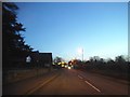
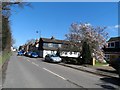
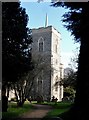
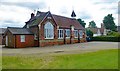
Photos of High Cross
Area Information
High Cross is a compact built-up area in England, spanning 30.5 hectares. It is a place where daily life unfolds within a tightly woven network of homes, shops, and transport links. The area’s population, while not explicitly detailed, reflects a median age of 70, suggesting a community with a significant proportion of older residents. Living here means proximity to essential services, with five retail outlets including Spar, Asda Ware, and Tesco Ware within reach. Rail connectivity is strong, with Ware Railway Station and Hertford East Railway Station offering links to nearby towns. High Cross is not a sprawling suburb but a focused, practical environment where convenience and accessibility define the rhythm of life. Its size and infrastructure cater to those seeking a settled, low-maintenance lifestyle, with homes primarily owner-occupied at 75%. For buyers, this area offers a blend of simplicity and functionality, ideal for those prioritising ease of access to amenities and transport over expansive living spaces.
- Area Type
- Built Up Area 250
- Area Size
- 30.5 hectares
- Population
- Not available
- Population Density
- Not available
High Cross offers a practical lifestyle with essential amenities within reach. Retail options include Spar, Asda Ware, and Tesco Ware, providing access to groceries and daily necessities. Rail stations such as Ware and Hertford East connect residents to broader regional networks, facilitating travel to nearby hubs. The absence of detailed data on leisure or recreational facilities means the area’s character beyond shopping and transport is not fully described. However, the proximity to multiple retail outlets and rail links suggests a community focused on convenience rather than expansive leisure opportunities. Daily life here revolves around practical needs, with limited emphasis on cultural or recreational amenities.
Amenities
Schools
The nearest school to High Cross is the Puller Memorial, Church of England, Voluntary Aided Primary School, which has an Ofsted rating of ‘good’. This primary school is the only explicitly named educational institution in the data, though no secondary schools or other educational facilities are listed. The presence of a primary school with a ‘good’ rating suggests that families with young children may find the area suitable for their needs, though the absence of secondary school data leaves gaps in understanding the full range of educational options. The single school mentioned indicates a limited number of choices for parents, which could be a consideration for those prioritising multiple schooling options.
| Rank | School | Type | Entry gender | Ages |
|---|
Explore more schools in this area
Go to Schools tabDemographics
The demographic profile of High Cross is shaped by its median age of 70, indicating a community where older residents form a significant portion of the population. Home ownership is high, with 75% of properties occupied by their owners, suggesting a stable and long-term resident base. The data does not specify household composition or accommodation types, but the overall figures imply a mature, settled population. There is no explicit information on ethnic diversity or religious composition, so these aspects remain unaddressed. The lack of detailed breakdowns on household types or deprivation levels means the area’s social dynamics are not fully quantified. However, the high home ownership rate and the presence of nearby amenities suggest a community that values stability and practicality over transient living arrangements.
Household Size
Accommodation Type
Tenure
Ethnic Group
Religion
Household Composition
Age
Household Deprivation
NS-SEC
Explore more demographic insights in this area
Go to Demographics tabPlanning
Planning Constraints
- Crime RiskPremium