Area Overview for St. Stephen
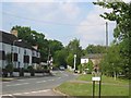
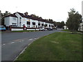
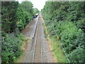
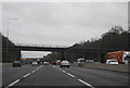
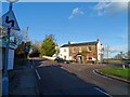
Photos of St. Stephen

Area Information
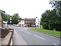
Living in St. Stephen offers a quiet existence within a civil parish that spans 23.6 square kilometres. The community serves approximately 5,952 residents, creating a population density of 252 people per square kilometre. This figure suggests a settled, residential environment rather than a busy commercial hub. The area is located in Hertfordshire, close to the market town of St Albans, which shapes daily life for those calling this parish home. History runs deep here; a Church of St Stephen was founded around the year 950 by Ulsinus, the sixth Abbot of St Albans. This medieval foundation stands as a testament to the parish's long-standing roots. By the 18th century, the community had established poor relief infrastructure, including a brick-built workhouse erected in 1725. The parish also formerly held tenements at Smallford and Park Street before selling them in 1836 to fund charitable causes like coal clubs. Today, the modern civil parish lacks the precise geographic boundaries that defined its medieval origins, yet the historic character remains visible. You will find high-speed connections and a settled neighbourly atmosphere. The area functions as a traditional village setting where past and present coexist without dramatic conflict.
- Area Type
- Parish
- Area Size
- 23.6 km²
- Population
- 5952
- Population Density
- 252 people/km²
Demographics
The community in St. Stephen is notably older than the national average. The median age stands at 70 years, which defines the demographic profile of the parish. Most residents fall into the total adult age bracket, indicating a population primarily composed of older adults. This age structure suggests a community where retirement living plays a central role in social life and local services. Home ownership is extremely prevalent, with 79% of households owning their property. This high rate contrasts sharply with private rental markets found in larger cities. You are likely to find established families or individuals who live in homes they have occupied for decades. Household composition reflects this stability, with no significant atypical groups dominating the statistics. The area does not report specific data on predominant ethnic groups or religious affiliations in the current dataset, which often points to a homogenous, long-standing settlement. While comprehensive data on deprivation levels is not explicitly detailed in the provided figures, the high ownership rate and older population typically correlate with stable, asset-rich neighbourhoods. Living here means sharing the space with peers who have likely watched their own children grow up elsewhere and now enjoy the relative peace of this Hertfordshire parish.
Household Size
Accommodation Type
Tenure
Ethnic Group
Religion
Household Composition
Age
Household Deprivation
NS-SEC
Explore more demographic insights in this area
Go to Demographics tabPlanning
Planning Constraints
- Flood RiskPremium
- Ramsar Wetland SitesPremium
- Area of Outstanding Natural BeautyPremium
- Protected Nature ReservePremium
- Protected WoodlandPremium