Area Overview for Harpenden Town
Photos of Harpenden Town


Area Information
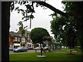
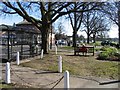
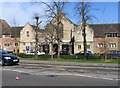
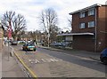
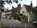
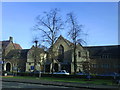
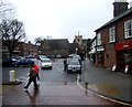
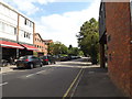
Harpenden Town is a civil parish located in Hertfordshire, East of England. You are considering living in an area covering 13.0 km² with a population of 12,488 people. The name derives from the Old English "Herpe dene," meaning the military path through the valley, referring to a Roman road that once linked Cheshunt and Dunstable. Historically, the site dates back to the Iron Age, with Roman villas found in the Ver valley. King Edward the Confessor granted the area to Westminster Abbey in 1060, and the first parish church reference appears in 1221. Today, Harpenden functions as a residential town with a pleasant character and proximity to the countryside. It evolved from an agricultural village into a commuter settlement for London after the Midland Railway arrived in 1860. The sale of the Packe and Pym estate over 1,000 acres in 1882 initiated significant residential development. The town centre retains a village character known locally as "the village." Nomansland Common on the southern edge hosts Harpenden Golf Club, established in 1894 with support from Sir John Bennet Lawes. You can also visit Rothamsted Experimental Station, the oldest laboratory devoted to agricultural research in the world, founded in 1843. While the area has modern development, it maintains a suburban feel influenced by its geographical setting on the dip slope of the Chiltern Hills.
- Area Type
- Parish
- Area Size
- 13.0 km²
- Population
- 12488
- Population Density
- 957 people/km²
Demographics
You will find a stable community in Harpenden Town where 72% of homes are owner-occupied. The demographic profile shows a median age of 70. This specific figure indicates an older population compared to the national average. Most common age ranges reflect this senior demographic. Households are comprised of total households, and accommodation types represent the total stock. The area contains no specific breakdown for predominant ethnic group or religion in the available records. With a density of 957 people per km², Harpenden remains relatively residential for its size. This high density suggests efficient land use within the 13.0 km² boundary. The age profile of 70 years old suggests this is not a hub for young families seeking active play spaces nearby. Instead, the community structure points to retirees or settled professionals. You should expect a quieter atmosphere rather than a bustling night scene. The 72% ownership rate confirms that long-term residents often stay put rather than renting. This stability supports local businesses like those serving the village centre. The lack of specific ethnic or religious data does not diminish the community's cohesion. You are entering an area defined by its established social fabric and mature housing stock.
Household Size
Accommodation Type
Tenure
Ethnic Group
Religion
Household Composition
Age
Household Deprivation
NS-SEC
Explore more demographic insights in this area
Go to Demographics tabPlanning
Planning Constraints
- Flood RiskPremium
- Ramsar Wetland SitesPremium
- Area of Outstanding Natural BeautyPremium
- Protected Nature ReservePremium
- Protected WoodlandPremium