Area Overview for Much Hadham
Photos of Much Hadham


Area Information
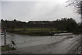
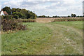
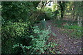
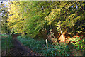
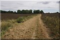
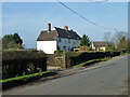
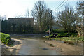
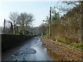
Much Hadham is a civil parish spanning 18.2 km² in England. You will find it to be a substantial rural community rather than a small hamlet. The area offers a quiet lifestyle defined by its open space and traditional character. Living in Much Hadham means relying on local amenities and established transport links rather than being surrounded by dense urban housing. Daily life here involves navigating a space where the population is spread out across a significant land area. The parish provides a setting where residents enjoy wide horizons and lower population density compared to nearby towns. You might appreciate the calm atmosphere that defines life in this part of the countryside. However, you should also accept that services will be less immediately accessible than in a larger borough. The distinctiveness of Much Hadham lies in its balance of rural reach and community cohesion. It is a place where the scale of the parish shapes the pace of your everyday routine.
- Area Type
- Parish
- Area Size
- 18.2 km²
- Population
- Not available
- Population Density
- Not available
Demographics
The community in Much Hadham has a distinctly mature profile. The median age for residents sits at 70 years. This indicates that the area is home to an older population rather than young families or newcomers. Households are dominated by age groups reflected in this high median figure. You will notice a significant portion of the population falls into older age brackets. Home ownership is very prevalent, with 69% of residents owning their property. This rate stands well above the national average for owner-occupation. The high percentage suggests long-term stability within the community. Most residents likely built their homes or purchased them decades ago and have remained there. This stability contributes to a consistent community feel where neighbours know one another well. The demographic structure implies fewer first-time buyers or dynamic new arrivals compared to mixed-age neighbourhoods. Deprivation levels are not highlighted in the current data, so you cannot assess economic disparity. Instead, focus on the clear age skew and high ownership rate that define who lives here.
Household Size
Accommodation Type
Tenure
Ethnic Group
Religion
Household Composition
Age
Household Deprivation
NS-SEC
Explore more demographic insights in this area
Go to Demographics tabPlanning
Planning Constraints
- Flood RiskPremium
- Ramsar Wetland SitesPremium
- Area of Outstanding Natural BeautyPremium
- Protected Nature ReservePremium
- Protected WoodlandPremium