Area Overview for Hertford Kingsmead Ward
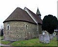
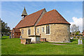
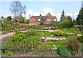
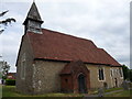
Photos of Hertford Kingsmead Ward

Area Information
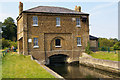
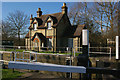
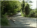
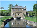
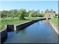
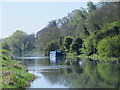
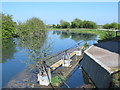
Living in Hertford Kingsmead Ward offers a distinct experience within the historic county town of Hertford. This electoral ward falls under East Hertfordshire District Council and covers a compact area of 2.5 km². The boundaries of Kingsmead were redrawn on 4 May 2023 to incorporate land previously situated in Hertford Castle ward, expanding the neighbourhood's footprint. You will find Kingsmead includes specific local landmarks such as Kingsmead Square, dedicated play areas, and Poor's Wood within its limits. These features create a recognised green and community space for residents. The ward is located at approximately 51.8008°N, 0.0589°W, placing it firmly in Eastern England. The area serves as an important part of the Hertford and Stortford region. Local governance links to the East Hertfordshire District Council planning policy. Kingsmead PC maintains an active presence regarding the ward's development. If you are exploring homes in Hertford Kingsmead Ward, you are entering a space defined by recent boundary changes and established local facilities. The location balances urban access with nearby natural reserves like Poor's Wood. This mix defines the character of daily life for anyone settling here.
- Area Type
- District Borough Unitary Ward
- Area Size
- 2.5 km²
- Population
- Not available
- Population Density
- Not available
Demographics
The community in Hertford Kingsmead Ward has a distinct age profile, with a median age of 70. This figure stands in sharp contrast to the national average and indicates a significant senior population residing in the ward. Most common age data is aggregated in the total group, suggesting a demographic skew towards older residents. Sixty-six per cent of households own their homes. This high ownership rate points to a settled community where long-term residents make up the majority. Household composition data reflects this stability across the total household count. Ethnic diversity and religion statistics are recorded for the area as a total. Accommodation types follow the same aggregation for the ward. The low median age combined with high home ownership suggests fewer young families or students compared to other Hertford areas. You must consider how this profile impacts local services and social activities. If you are looking for homes in Kingsmead, expect a neighbourhood driven by older, property-owning residents. The demographic landscape shapes the pace of life and the types of amenities that thrive here.
Household Size
Accommodation Type
Tenure
Ethnic Group
Religion
Household Composition
Age
Household Deprivation
NS-SEC
Explore more demographic insights in this area
Go to Demographics tabPlanning
Planning Constraints
- Flood RiskPremium
- Ramsar Wetland SitesPremium
- Area of Outstanding Natural BeautyPremium
- Protected Nature ReservePremium
- Protected WoodlandPremium
- Crime RiskPremium