Area Overview for Hertford Heath & Brickendon Ward
Photos of Hertford Heath & Brickendon Ward
Area Information
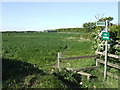
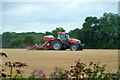
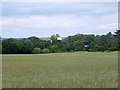
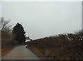
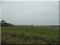
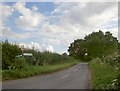
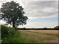
Hertford Heath & Brickendon Ward stands as a distinct district within Hertfordshire, covering an expansive 19.8 km². You are entering an area where history and landscape define the everyday experience rather than rapid urban development. This ward offers a setting that balances residential comfort with significant natural features. The landscape is not left to chance; it contains designated protected nature reserves and substantial areas of protected woodland, ensuring the environment remains a central character in your daily life. These features act as planning constraints, meaning new construction will be carefully managed to preserve the local character. The region attracts those seeking a quieter life while maintaining access to essential services and nature. When you consider living in Hertford Heath & Brickendon Ward, you are choosing a space where the physical layout supports a slower pace of living. The area size allows for sufficient space between homes, contributing to a less congested atmosphere compared to larger urban boroughs. You will find that the distinct boundaries of this ward create a clear identity. This identity is reinforced by the local environment, which prioritizes conservation alongside community living.
- Area Type
- District Borough Unitary Ward
- Area Size
- 19.8 km²
- Population
- Not available
- Population Density
- Not available
Demographics
The community profile of Hertford Heath & Brickendon Ward reveals a heavily established population. Residents tend to be older, with a median age of 70 years. This statistic indicates a retired or semi-retired demographic rather than a young family-centric zone. You will likely encounter fewer children and teenagers on the streets compared to other districts. Home ownership is extremely high within this ward, standing at 69% of households. This figure suggests stability, as the majority of residents put down roots rather than renting temporarily. The area also supports a wide variety of housing needs through its diverse household composition and accommodation types. Although specific data on ethnic composition and dominant religious groups are not currently detailed in available records, the social fabric is shaped by this older, owner-occupier demographic. Living in Hertford Heath & Brickendon Ward means joining a community where long-term residence is the norm. You should expect neighbours who have lived in the district for decades, creating established routines and community bonds. The age profile and ownership levels point to a quiet, stable neighbourhood where change happens slowly.
Household Size
Accommodation Type
Tenure
Ethnic Group
Religion
Household Composition
Age
Household Deprivation
NS-SEC
Explore more demographic insights in this area
Go to Demographics tabPlanning
Planning Constraints
- Flood RiskPremium
- Ramsar Wetland SitesPremium
- Area of Outstanding Natural BeautyPremium
- Protected Nature ReservePremium
- Protected WoodlandPremium
- Crime RiskPremium