Area Overview for Henstead with Hulver Street
Photos of Henstead with Hulver Street
Area Information
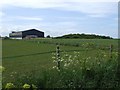
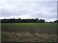
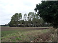
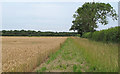
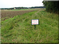
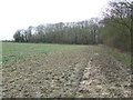
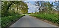
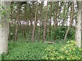
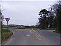
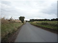
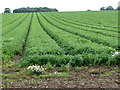
Living in Henstead with Hulver Street offers a rural experience defined by its position as a civil parish in the East Suffolk district. This community spans 7.9 square kilometres, forming a compact area where the villages of Henstead and Hulver Street operate closely together. You are situated roughly 5 miles south-west of Lowestoft and 5 miles south-east of Beccles, placing you midway between these larger towns. Six miles to the north lies Southwold, a coastal destination that remains a significant point of reference. The landscape is shaped by the Hundred River Valley, which flows to your south. This river creates a peaceful setting dominated by marshes and farmland, providing a natural boundary for the settlement. The parish church in Henstead serves as a central historic landmark within the village. Transport links rely on the A12 motorway crossing the eastern border and the B1127 road connecting Beccles to Benacre, which passes directly through Hulver Street. Your daily life revolves around this quiet connection to the countryside, with the Hundred River defining much of your northern perimeter. The area borders eight other parishes, including Benacre, Gisleham, and Mutford, creating a network of local communities. For those seeking homes in this region, the environment remains relatively secluded yet accessible via the main road routes that fringe the parish.
- Area Type
- Parish
- Area Size
- 7.9 km²
- Population
- Not available
- Population Density
- Not available
Demographics
The community in Henstead with Hulver Street has a distinct demographic profile compared to many modern towns. You will find a median age of 70 across the parish, indicating an area populated predominantly by older residents. The data shows that the most common age group recorded is simply labelled as 'Total', but the central tendency clearly points towards retirement-age dwelling. Home ownership stands at 68 per cent, meaning a significant majority of households have their property outright or via mortgage rather than renting. This high ownership rate typically correlates with families staying in their homes for extended periods or later-life residents settling into rural properties. The available information covers total household composition and total accommodation types without breaking down specific family sizes or single-person households. While diverse datasets often highlight ethnicity and religious breakdowns, the provided records only list these categories as 'Total', showing no specific predominant ethnic or religious group. The absence of detailed deprivation statistics in the current records means you cannot assess income inequality directly. However, the age structure suggests a community that may rely heavily on local services for older demographics rather than bustling family hubs. You are purchasing into an area where life moves more slowly, reflecting the gentle rhythm of the surrounding marshlands.
Household Size
Accommodation Type
Tenure
Ethnic Group
Religion
Household Composition
Age
Household Deprivation
NS-SEC
Explore more demographic insights in this area
Go to Demographics tabPlanning
Planning Constraints
- Flood RiskPremium
- Ramsar Wetland SitesPremium
- Area of Outstanding Natural BeautyPremium
- Protected Nature ReservePremium
- Protected WoodlandPremium
- Crime RiskPremium