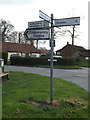
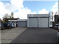
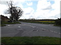
Area Overview for Henley
Photos of Henley


Area Information
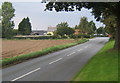
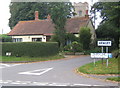
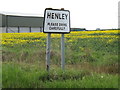
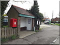
Henley is a compact built-up area in England, spanning 24.3 hectares. Its population is predominantly older, with a median age of 70, reflecting a community shaped by long-term residents. Home ownership here is exceptionally high at 84%, indicating a stable, settled population. Daily life in Henley is defined by proximity to essential services, including five retail outlets such as Morrisons Daily and Budgens, and five rail stations like Westerfield Railway Station, offering easy access to regional transport. The area’s small size means amenities are within practical reach, fostering a self-contained lifestyle. While the broadband score is modest at 49, mobile coverage is stronger at 78, supporting basic connectivity. Henley’s appeal lies in its quiet, established character, with schools like Henley Primary School providing a foundation for families. For those seeking a low-maintenance, community-focused environment, Henley offers a blend of practicality and tradition.
- Area Type
- Built Up Area 250
- Area Size
- 24.3 hectares
- Population
- Not available
- Population Density
- Not available
Residents of Henley have access to five retail outlets, including East of England Co-operative Co and Morrisons Daily, ensuring convenience for everyday shopping. The rail network, with stations like Entrance2 and Needham Market Railway Station, offers easy access to nearby towns and cities. While the area lacks detailed information on parks or leisure facilities, the proximity to retail and transport suggests a focus on practical living. The combination of shops and rail links makes daily life efficient, though leisure options may require venturing further afield. This lifestyle suits those prioritizing accessibility over expansive recreational spaces.
Amenities
Schools
Henley Primary School is the only named school in the area, offering primary education with a good Ofsted rating. This single school serves the local community, providing a foundation for families with young children. The absence of secondary schools or additional educational institutions means parents may need to look beyond Henley for comprehensive schooling. However, the good rating at Henley Primary School suggests a reliable standard of education for younger students. For families prioritizing proximity to schools, this is a key factor, though the limited range of educational options may influence decisions about long-term residency.
| Rank | School | Type | Entry gender | Ages |
|---|
Explore more schools in this area
Go to Schools tabDemographics
Henley’s population is skewed towards older adults, with a median age of 70. This suggests a community with a strong presence of retirees and long-term residents, which influences local dynamics and service needs. Home ownership is high at 84%, indicating a preference for stable, long-term living over rental properties. The data does not specify household types or ethnic diversity, but the overall composition appears homogeneous. The absence of detailed figures on deprivation or diversity means the area’s social fabric remains less defined in statistical terms. For residents, this demographic profile implies a quieter, more predictable environment, with services and infrastructure tailored to older generations. The high home ownership rate also suggests a market where property is viewed as a long-term investment rather than a transient asset.
Household Size
Accommodation Type
Tenure
Ethnic Group
Religion
Household Composition
Age
Household Deprivation
NS-SEC
Explore more demographic insights in this area
Go to Demographics tabPlanning
Planning Constraints
- Crime RiskPremium