Area Overview for Hempnall
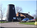
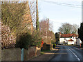
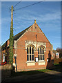
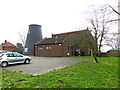
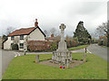
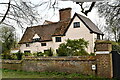
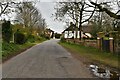
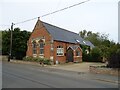
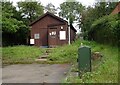
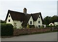
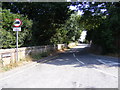
Photos of Hempnall

Area Information
Hempnall is a built-up area in England covering 49.7 hectares, offering a compact yet functional living environment. With a median age of 70, the community reflects a demographic skewed toward older residents, which shapes the area’s character and pace of life. Home ownership is high, at 79%, suggesting a stable, long-term presence of residents. The area is served by Hempnall Primary School, rated ‘good’ by Ofsted, ensuring accessible education for local families. Nearby, three retail outlets—Morrisons Daily, East of England Co-operative Co, and Co-op Mulbarton—provide essential shopping options within practical reach. While the area’s size is modest, it combines proximity to amenities with a quieter, less congested atmosphere. For those seeking a retirement-focused or low-maintenance lifestyle, Hempnall’s infrastructure and community profile cater to such needs. Its digital connectivity, with broadband and mobile scores in the upper 70s, supports modern living without the pressure of urban density. The area’s safety, with a crime risk score of 89, further enhances its appeal for those prioritising security. Hempnall is a place where practicality meets tranquillity, ideal for those content with a slower pace of life.
- Area Type
- Built Up Area 250
- Area Size
- 49.7 hectares
- Population
- Not available
- Population Density
- Not available
Hempnall’s lifestyle is shaped by its proximity to three retail outlets: Morrisons Daily, East of England Co-operative Co, and Co-op Mulbarton. These stores provide essential shopping, from groceries to household goods, ensuring residents have access to daily necessities without long commutes. The area’s compact size means these amenities are within practical reach, supporting a self-contained lifestyle. While the data does not mention parks or leisure facilities, the presence of multiple retail options suggests a focus on convenience over expansive recreational spaces. For residents, this means a practical, no-frills approach to daily living, with an emphasis on accessibility. The limited data on other amenities means the area’s full lifestyle offerings remain partially unexplored, but the existing retail network ensures basic needs are met efficiently.
Amenities
Schools
Hempnall Primary School is the only school listed in the area, serving local children with a primary education. Rated ‘good’ by Ofsted, it provides a reliable foundation for young learners. The absence of secondary schools or other educational institutions within the immediate vicinity means families may need to consider commuting for higher education. This school is the primary option for parents in the area, and its rating suggests a focus on quality teaching and student outcomes. For those prioritising proximity to schools, Hempnall offers a straightforward solution, though the lack of additional educational facilities may limit choices for older students. The school’s presence reinforces the area’s appeal to families seeking a stable, well-supported environment for their children.
| Rank | A + A* % | School | Type | Entry gender | Ages |
|---|---|---|---|---|---|
| 1 | N/A | Hempnall Primary School | primary | N/A | N/A |
Explore more schools in this area
Go to Schools tabDemographics
Hempnall’s population is predominantly older, with a median age of 70, indicating a community where retirement and long-term residency are common. The most common age range is listed as ‘Age: Total’, reflecting an aggregated demographic profile rather than a breakdown of specific groups. Home ownership is high, at 79%, suggesting most residents live in properties they own, which aligns with the area’s stability. Household composition and accommodation types are not specified, but the overall data implies a mix of family and single-occupancy homes. The area’s ethnic and religious diversity is not detailed, but the ‘total’ designation for these categories suggests a lack of granular data. This demographic profile means services and amenities are likely tailored to older residents, with fewer demands for childcare or youth facilities. The high home ownership rate also indicates a community where property values may be less volatile, offering security for long-term residents. However, the absence of specific data on diversity or deprivation means the area’s social dynamics remain partially opaque.
Household Size
Accommodation Type
Tenure
Ethnic Group
Religion
Household Composition
Age
Household Deprivation
NS-SEC
Explore more demographic insights in this area
Go to Demographics tabPlanning
Planning Constraints
- Crime RiskLocked