Area Overview for Helhoughton
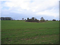
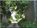
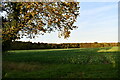
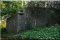
Photos of Helhoughton
Area Information
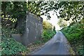
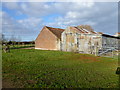
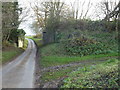
Living in Helhoughton means settling into a civil parish that spans 6.8 km² in the quiet interior of England. This rural setting offers a distinct pace of life far removed from the constraints of city living. The area functions as a close-knit community rather than a sprawling development, which influences the daily rhythm for all residents. You will find yourself surrounded by open spaces and established villages, creating an environment where residents enjoy a slower lifestyle. The limited footprint of the parish suggests a preserved character where new construction must carefully integrate with the existing rural landscape. Homebuyers considering this location are entering a market defined by stability and tradition. The area does not offer modern urban conveniences immediately at your doorstep, yet it provides a serene backdrop for those seeking a retreat. Your morning routine likely involves traversing the narrow roads of the parish, connecting to wider networks via public transport routes or personal vehicles. The sense of place here is rooted in long-standing local history and agricultural heritage. You will appreciate the absence of heavy traffic and the visual dominance of green fields and hedgerows. This parish represents a specific choice for buyers prioritising privacy and quiet over proximity to employment hubs. The 6.8 km² extent ensures that you never feel overwhelmed by density. Your neighbours are likely to share similar values regarding conservation and community cohesion. Daily life revolve around local happenings, seasonal changes, and the maintenance of the distinctive rural architecture that defines the Helhoughton skyline.
- Area Type
- Parish
- Area Size
- 6.8 km²
- Population
- Not available
- Population Density
- Not available
Demographics
The community in Helhoughton reflects a settled population with a median age of 70 years. This figure indicates that the area is predominantly inhabited by older residents, likely drawn by the quiet environment and lower cost of living. You will find fewer young families or professional students compared to urban centres, which shapes the social atmosphere significantly. The demographic profile suggests a neighbourhood where established homeowners passed down properties or retired from active careers to these rural surroundings. Home ownership stands at 67%, a strong indicator of long-term residence and financial stability within the parish. This high rate means that a significant portion of the householders have secured their properties and are unlikely to move frequently. Consequently, the local community often features the same families living in the same homes for decades. The lower rate of rental accommodation reinforces the stability of the area, as properties remain with owners who value their investments and wish to avoid disruption. While the data does not specify household composition breakdowns, the high ownership rate implies traditional family structures or individuals living alone. The ethnic composition and religious affiliations follow the broader national patterns, though local diversity remains limited given the rural nature of the civil parish. Residents here generally value stability over rapid demographic shifts. When you buy a home in Helhoughton, you join a community where neighbours have known each other for generations, fostering a supportive yet traditional social fabric. The age profile means that local services often cater to the needs of an ageing population, influencing the types of amenities locally available.
Household Size
Accommodation Type
Tenure
Ethnic Group
Religion
Household Composition
Age
Household Deprivation
NS-SEC
Explore more demographic insights in this area
Go to Demographics tabPlanning
Planning Constraints
- Flood RiskPremium
- Ramsar Wetland SitesPremium
- Area of Outstanding Natural BeautyPremium
- Protected Nature ReservePremium
- Protected WoodlandPremium
- Crime RiskPremium