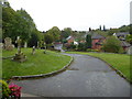
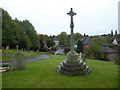
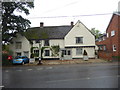
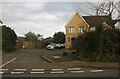
Area Overview for Hedingham Ward
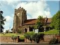
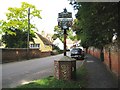
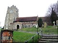
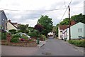
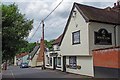
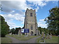
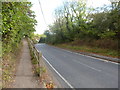
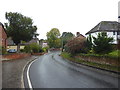
Photos of Hedingham Ward
Area Information
Living in Hedingham Ward offers a quiet existence within the Bourne End civil parish. You will find yourself in a district borough unitary ward covering an area of 31.5 km². The population stands at 1,692 residents, creating a very low-density environment with just 54 people per km². This remains the smallest of its kind in the district by far. Daily life here moves at a slower pace compared to larger urban centres. The small population means you will rarely encounter the congestion or noise typical of more crowded locations. However, the sheer isolation is a defining feature of the area. You are part of a community where neighbours know one another well due to the limited number of households. The ward is situated entirely within England and holds a distinct identity as a rural settlement. While the lack of large public amenities is a reality of such a small footprint, the trade-off is a serene atmosphere. You do not need to commute far to find the main services of Bourne End. This makes Hedingham Ward suitable for those seeking separation from the bustle of county life. The landscape supports a tranquil lifestyle centred on local connectivity.
- Area Type
- District Borough Unitary Ward
- Area Size
- 31.5 km²
- Population
- 1692
- Population Density
- 54 people/km²
Demographics
The community in Hedingham Ward is notably older than the national average. The median age in your neighbourhood is 70 years. This indicates a population heavily skewed towards older residents. The available data lists the most common age range as Age: Total, reflecting the broad age spread within this elderly demographic. You will find that the area is dominated by long-term residents rather than young families or students. Home ownership levels stand at 71%, which is relatively high for the region. This figure confirms that the majority of households in Hedingham Ward are owner-occupied. The social fabric is stable, rooted in established local families. While the data does not break down specific household composition details beyond the total, the high ownership rate suggests multi-generational families often reside together. Conversely, there is a smaller cohort of private renters compared to other parts of the district. The predominance of ethno-religious diversity data is marked as total, meaning the ward maintains a homogenous character consistent with its rural setting. You are unlikely to find significant cultural diversity in terms of ethnic groups or religious demographics. This lack of diversity reinforces the traditional, insular nature of living here. For buyers, this demographic profile means peer groups will generally share similar life stages and values.
Household Size
Accommodation Type
Tenure
Ethnic Group
Religion
Household Composition
Age
Household Deprivation
NS-SEC
Explore more demographic insights in this area
Go to Demographics tabPlanning
Planning Constraints
- Flood RiskPremium
- Ramsar Wetland SitesPremium
- Area of Outstanding Natural BeautyPremium
- Protected Nature ReservePremium
- Protected WoodlandPremium