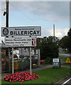
Area Overview for Havering's Grove
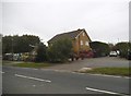
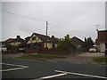
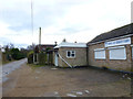
Photos of Havering's Grove


Area Information
Havering’s Grove is a compact built-up area spanning 45.7 hectares, situated in England. Its character is defined by a mature population, with a median age of 70, suggesting a community rooted in stability and long-term residency. This area is not defined by sprawling suburbs but by a tightly knit, practical living environment. Daily life here is shaped by proximity to essential services, with five retail outlets within reach, including Sainsburys Billericay and Iceland Billericay. Rail connectivity is robust, with five stations nearby, including Billericay and Shenfield, offering easy access to commuting routes. The area’s appeal lies in its balance of accessibility and quietude, ideal for those prioritising convenience without sacrificing a sense of place. For homebuyers, Havering’s Grove presents a straightforward proposition: established infrastructure, a low crime risk, and a community that reflects decades of settled habitation. Its size ensures a manageable footprint, while its amenities cater to both practical needs and a lifestyle centred on ease of movement and local access.
- Area Type
- Built Up Area 250
- Area Size
- 45.7 hectares
- Population
- Not available
- Population Density
- Not available
Living in Havering’s Grove offers access to a range of essential amenities within close proximity. The retail sector includes major names like Sainsburys Billericay, Iceland Billericay, and Cook Billericay, ensuring residents have convenient access to groceries and everyday shopping. Rail stations such as Billericay, Shenfield, and Ingatestone provide seamless connections to nearby towns and cities, supporting both commuter needs and weekend travel. While the data does not specify parks or leisure facilities, the presence of multiple retail and transport hubs suggests a lifestyle focused on practicality and accessibility. The area’s character is defined by its straightforward, no-frills approach to daily living, where convenience and reliability take precedence. For those who value ease of access to services and a well-connected community, Havering’s Grove delivers a functional, low-maintenance lifestyle.
Amenities
Schools
| Rank | School | Type | Entry gender | Ages |
|---|
Explore more schools in this area
Go to Schools tabDemographics
The population of Havering’s Grove has a median age of 70, the highest recorded in the dataset, indicating a community predominantly composed of older adults. This age profile suggests a demographic skewed towards retirees or long-term residents, which may influence local services and social dynamics. Home ownership is high, at 81%, reflecting a stable housing market where most residents are likely to have long-term ties to the area. The data does not specify household composition or accommodation types, but the overall figures imply a settled, low-turnover population. The absence of detailed diversity metrics means the ethnic and religious composition remains unspecified, though the ‘total’ designation for these categories suggests a broad, non-specific demographic profile. For quality of life, the older population may necessitate accessible public services and healthcare infrastructure, which are practical considerations for prospective buyers.
Household Size
Accommodation Type
Tenure
Ethnic Group
Religion
Household Composition
Age
Household Deprivation
NS-SEC
Explore more demographic insights in this area
Go to Demographics tabPlanning
Planning Constraints
- Crime RiskPremium