Area Overview for Haverhill West Ward
Photos of Haverhill West Ward
Area Information
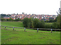
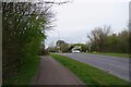
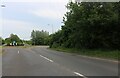
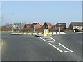
Haverhill West Ward is a compact residential district covering 2.4 square kilometres within the larger market town of Haverhill. This boundary was formally established by the Local Government Boundary Commission in 2018, coming into force on 2 May 2019. Residents benefit from a location that lies approximately 14 miles southeast of Cambridge and 47 miles northeast of central London. The ward sits in the Eastern English Region, positioned near the borders of Essex and Cambridgeshire. The surrounding landscape is defined by the chalk hills of the Newmarket Ridge to the west and Stour Brook running through the wider town area. Living in Haverhill West Ward offers easy access to the wider region while maintaining a connection to the historic East Anglian countryside. Although you may not find extensive details on specific internal street layouts in current reports, the ward functions as a distinct electoral division within Haverhill. The area serves as a practical base for those working in West Suffolk or commuting to greater London, blending town life with proximity to the surrounding agricultural land.
- Area Type
- District Borough Unitary Ward
- Area Size
- 2.4 km²
- Population
- Not available
- Population Density
- Not available
Demographics
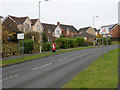
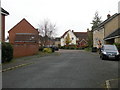
The community within Haverhill West Ward is defined by an older population profile compared to many parts of the United Kingdom. The median age for residents is 70 years, indicating a late-life community where many households consist of retirees or long-term residents. Home ownership stands at a significant 70 per cent, suggesting that the majority of houses in Haverhill West Ward are privately owned rather than rented. This high level of tenure implies a stable population with established roots in the area. While specific data on household composition, accommodation types, and predominant ethnic groups are not provided in the current search results, the age structure points towards a quiet residential environment. You should note that this demographic pattern mirrors many historic market towns where housing stock caters to older buyers. The area does not appear to suffer from high deprivation, aligning with a neighbourhood where stability is the norm. When considering homes in Haverhill West Ward, expect to find properties that have been owned for many years by the current occupants.
Household Size
Accommodation Type
Tenure
Ethnic Group
Religion
Household Composition
Age
Household Deprivation
NS-SEC
Explore more demographic insights in this area
Go to Demographics tabPlanning
Planning Constraints
- Flood RiskPremium
- Ramsar Wetland SitesPremium
- Area of Outstanding Natural BeautyPremium
- Protected Nature ReservePremium
- Protected WoodlandPremium
- Crime RiskPremium