Area Overview for Haverhill South East Ward
Photos of Haverhill South East Ward

Area Information
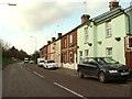
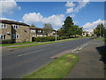
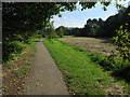
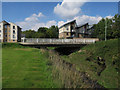
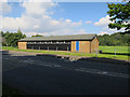
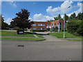
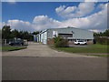
Haverhill South East Ward sits within the expanding settlement of Haverhill, located in Suffolk, England. This district council ward covers just 1.2 km², yet it represents a significant part of the market town's fabric. The ward lies approximately 14 miles southeast of Cambridge and 47 miles northeast of central London, positioning it next to the borders of Essex and Cambridgeshire. The town centre rests at the base of the chalk hills of the Newmarket Ridge, offering a distinct geographical setting. Life in this area is defined by its history and recent growth. Haverhill gained its formal administrative status as an urban district in 1894, but the modern landscape reflects substantial mid-20th century expansion. Residential developments like the Withersfield Road estate and Coupals Road estate appeared in 1964. These estates are part of the evolving housing stock that defines the South East ward today. You find yourself living in a community that has transitioned from traditional agricultural roots to a more built-up town environment. The area functions as a key residential zone within the larger borough, balancing the needs of local commuters with established neighbourhood infrastructure. This ward offers a sense of place rooted in market town traditions, even as the population continues to shift.
- Area Type
- District Borough Unitary Ward
- Area Size
- 1.2 km²
- Population
- Not available
- Population Density
- Not available
Demographics
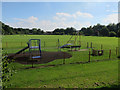
The community living in Haverhill South East Ward presents a clearly defined age profile. The median age is 70 years, indicating that the resident population skews significantly towards older adults. The data categorises the most common age group as 'Age: Total', which suggests a broad demographic spread where senior citizens form the dominant cohort. This high median age contrasts with typical family-heavy suburbs, pointing to an area where established residents remain in their homes as they age. Home ownership forms the backbone of the local economy and family structures. Sixty-six per cent of residents in this ward own their homes outright or with a mortgage. This high level of equity suggests financial stability within the community and potentially slower housing turnover compared to high-rental zones. You are joining a market where inherited homes and long-term occupants are the norm rather than the exception. The household composition data indicates a total population count without specifying single-person or multi-generation statistics, which aligns with the older median age. Accommodation types are distributed across the ward, reflecting the mixed history of development from the 1950s industrial era to the 1960s housing estates. This demographic profile means you will be living among neighbours who have likely resided in their localities for decades, creating deep-rooted community bonds.
Household Size
Accommodation Type
Tenure
Ethnic Group
Religion
Household Composition
Age
Household Deprivation
NS-SEC
Explore more demographic insights in this area
Go to Demographics tabPlanning
Planning Constraints
- Flood RiskPremium
- Ramsar Wetland SitesPremium
- Area of Outstanding Natural BeautyPremium
- Protected Nature ReservePremium
- Protected WoodlandPremium
- Crime RiskPremium