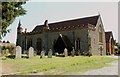
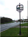
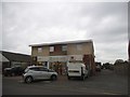
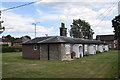
Area Overview for Hatfield Peverel
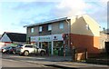
Photos of Hatfield Peverel


Area Information
Hatfield Peverel is a small built-up area in England, covering just 1.2 km². Its compact size means residents can easily access local amenities, shops, and transport links without long commutes. The area’s population is predominantly older, with a median age of 70, suggesting a community with a strong sense of continuity and established social networks. Daily life here is shaped by proximity to essential services, including multiple retail outlets and railway stations. The presence of two primary schools with good Ofsted ratings ensures families have access to quality education. While the area is modest in size, it offers a blend of practicality and convenience, making it appealing to those seeking a quieter, well-connected lifestyle. Its rail connections to nearby towns like Witham and White Notley provide flexibility for commuters, while the high broadband score supports remote work and digital connectivity. For buyers prioritising ease of access and a stable, mature community, Hatfield Peverel presents a straightforward, no-frills option.
- Area Type
- Built Up Area 250
- Area Size
- 1.2 km²
- Population
- Not available
- Population Density
- Not available
Living in Hatfield Peverel offers access to a range of local amenities within practical reach. The area is served by five retail outlets, including East of England Co-operative Co, Asda Witham, and Aldi Witham, providing everyday shopping convenience. These stores cater to household needs, from groceries to general retail. The presence of multiple railway stations, such as Hatfield Peverel and Witham, enhances mobility, allowing residents to travel to nearby towns for work, leisure, or services. While the data does not mention parks or leisure facilities, the proximity to rail links and retail hubs suggests a lifestyle focused on practicality and connectivity. The compact nature of the area means that daily errands and social activities can be managed without long journeys. For those valuing accessible services and a straightforward, no-frills lifestyle, Hatfield Peverel’s amenities align with a community prioritising convenience over extensive leisure options.
Amenities
Schools
Hatfield Peverel has two primary schools within its boundaries: Hatfield Peverel Infant and Nursery School and Hatfield Peverel St Andrew’s Junior School. Both institutions hold a good Ofsted rating, reflecting satisfactory standards in education. The presence of two primary schools ensures that families have access to early years and junior education without needing to travel far. However, the data does not include secondary schools or further education providers in the area, which may be a consideration for parents planning long-term schooling. The good ratings suggest that the schools meet national benchmarks, though specific details on curriculum, facilities, or student performance are not provided. For families prioritising proximity to quality primary education, Hatfield Peverel offers a reliable option, but additional research would be needed for secondary schooling options.
| Rank | School | Type | Entry gender | Ages |
|---|
Explore more schools in this area
Go to Schools tabDemographics
The population of Hatfield Peverel has a median age of 70, indicating a community skewed towards older adults. This age profile suggests a demographic with long-term residency and established social ties. Home ownership is high, with 73% of properties owner-occupied, reflecting a stable housing market. The data does not specify household composition or accommodation types, but the overall figures imply a mix of family homes and single-occupancy properties. The area’s demographics do not include detailed information on ethnic diversity or religious composition, but the absence of specific categories suggests a homogenous population. For those considering quality of life, the high home ownership rate and low median age may indicate a mature, low-turnover community. However, the lack of data on deprivation or socioeconomic factors means it is difficult to assess broader living conditions beyond the provided statistics.