Area Overview for Hatfield Central Ward
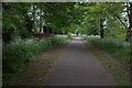
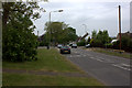
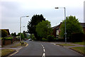
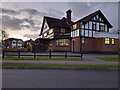
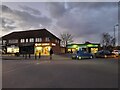
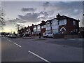
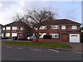
Photos of Hatfield Central Ward

Area Information
Hatfield Central Ward forms part of the Welwyn Hatfield Borough in Hertfordshire, occupying a compact area of 2.0 km². This electoral ward lies near the town centre, positioning residents within easy reach of local amenities and key transport routes. The location includes specific streets such as Harmony Close, Wellands, and Hillfield, which define the immediate neighbourhood experience. The ward functions as an integral component of Hatfield, benefiting from its central placement within the borough. You will find yourself situated close to the Great Northern Railway infrastructure, facilitated by the nearby Hatfield station. The A1 road also passes through the borough, ensuring strong road links for those commuting beyond the local area. This ward provides a defined pocket of living space that benefits from established transport connections. While the area is geographically small, its position near key arteries makes it practical for daily travel. The physical scale of 2.0 km² suggests a dense, accessible environment where most essentials are within short range. Living in Hatfield Central Ward means embracing a location that balances proximity to the town centre with specific local street networks. The ward serves as a distinct zone within the wider town, offering a clear sense of place defined by its boundary and access points. The community character of Hatfield Central Ward is defined by a notably older population profile. The median age here stands at 70 years, indicating that the average resident is significantly older than the national norm. Most households are likely composed of older individuals or couples, reflecting this advanced age demographic. Home ownership rates reach 40% across the ward, meaning a substantial portion of the population owns their property outright or via a mortgage. The remaining households may comprise private renters or social housing occupants, though specific breakdowns for these groups are not detailed in the available statistics. The ward does not provide specific data on the predominant ethnic group or religious affiliation, so the multicultural composition of the area remains undefined by current figures. Despite the lack of detailed demographic breakdowns, the high median age clearly shapes the social environment. You are entering a neighbourhood where older residents dominate the landscape for both residential and local service needs. This profile suggests a quieter, perhaps more settled environment compared to areas with younger populations. The 40% ownership figure indicates a blending of ownership and rental sectors, though the exact nature of rental demand is unclear. Understanding who lives here requires focusing on these clear statistical markers rather than speculating about unrecorded diversity factors. The property market in Hatfield Central Ward reflects a landscape dominated by older demographics and a moderate level of home ownership. Current data shows that 40% of residents are homeowners, leaving the other 60% occupied through rental arrangements. This split suggests a balanced mix of owner-occupiers and renters, though the specific types of accommodation vary within the ward. The ward covers 2.0 km², which implies a relatively high density of housing for such a small geographical footprint. You can expect to find a variety of property types suitable for older residents, including flats and perhaps some detached houses in the central ward locations. The existing stock likely caters to the median age of 70, meaning many homes may feature layouts and designs from previous decades. Specific details regarding the ratio of flats to houses are not provided, so you must assess individual properties for suitability. The 40% ownership rate indicates that while there is a market for buyers, there is also a significant rental sector to consider. Homes in Hatfield Central Ward are situated near the town centre, likely benefiting from established local infrastructure. When looking at properties, focus on their proximity to the streets known in the area, such as Harmony Close and Hillfield. The market dynamics here are shaped by the age profile, creating a specific demand for accessible housing solutions. Digital connectivity in Hatfield Central Ward is excellent, supporting modern living and remote work requirements without issue. The fixed broadband quality score reaches 93 out of 100, ensuring reliable high-speed internet access for households. This superior connectivity means you can stream media, work from home, and handle digital tasks with confidence. There are no reported issues with internet performance that would hinder daily digital needs for a large landline or wireless setup. Physical transport links are equally robust, with the Great Northern Railway providing station services to the ward. Hatfield station serves the local area, offering rail connections that extend well beyond Herts. Additionally, the A1 road passes through the borough, providing a major arterial route for car journeys. You have access to both rail and major road networks, ensuring flexibility in your daily travel routines. The combination of nearby railway stations and the A1 means commuting to London or other regional hubs is straightforward. Your daily commute will likely involve either a short walk to the rail station or a drive along the main road. This dual transport infrastructure ensures that isolation from major employment centres is not a concern for residents. Safety assessments reveal a mixed picture for Hatfield Central Ward, with significant variations between environmental risks and personal security. The flood risk assessment passes with a score of 7.51 on a scale where lower is better, indicating a low flood risk for properties in the ward. There is no coverage of Ramsar wetland sites, Areas of Outstanding Natural Beauty, or protected nature reserves within the boundaries. Furthermore, there is no protected woodland coverage affecting planning constraints for new developments. These environmental factors present minimal obstruction to residential tranquility and property development plans. However, the crime risk assessment marks a critical concern with a score of 33 on the safety scale. This low score indicates high crime risk, as crime rates above average trigger this classification. Residents must take enhanced security measures to protect their homes and families. The Criminal Justice Board has flagged this area as requiring vigilance due to elevated offending levels. While the environment is free from major planning constraints and flooding threats, the personal safety profile demands attention. You should consider installing security systems and being aware of your surroundings, given the high crime risk classification. Balancing the safe environmental conditions with the need for robust personal security is essential when planning to live here. What is the home ownership situation in Hatfield Central Ward?Home ownership accounts for 40% of households in the ward. The remaining 60% of the population lives in other accommodation types, though specific rental statistics are not detailed in current data. This indicates a mixed market with a significant portion of residents owning their homes. How good is the internet connection for working from home?Digital connectivity is excellent, with a fixed broadband quality score of 93 out of 100. This high rating ensures reliable high-speed internet suitable for remote work, streaming, and daily online activities without interruption. Is the area safe from natural hazards like flooding?The area passes the flood risk assessment with a score of 7.51, indicating a low flood risk for properties. There are also no planning constraints from Ramsar sites, AONBs, or protected reserves affecting the land. What are the main transport links for residents?Residents have access to the Great Northern Railway via Hatfield station and the A1 road passes through the borough. These provide robust rail and road connections for commuting and daily travel needs throughout the day. What is the crime situation like for prospective homebuyers?The crime risk level is critical with a score of 33, placing it above the average for the region. High crime rates necessitate enhanced security measures. You should be aware of these elevated risks when considering a move to the ward.
- Area Type
- District Borough Unitary Ward
- Area Size
- 2.0 km²
- Population
- Not available
- Population Density
- Not available
Demographics
The community character of Hatfield Central Ward is defined by a notably older population profile. The median age here stands at 70 years, indicating that the average resident is significantly older than the national norm. Most households are likely composed of older individuals or couples, reflecting this advanced age demographic. Home ownership rates reach 40% across the ward, meaning a substantial portion of the population owns their property outright or via a mortgage. The remaining households may comprise private renters or social housing occupants, though specific breakdowns for these groups are not detailed in the available statistics. The ward does not provide specific data on the predominant ethnic group or religious affiliation, so the multicultural composition of the area remains undefined by current figures. Despite the lack of detailed demographic breakdowns, the high median age clearly shapes the social environment. You are entering a neighbourhood where older residents dominate the landscape for both residential and local service needs. This profile suggests a quieter, perhaps more settled environment compared to areas with younger populations. The 40% ownership figure indicates a blending of ownership and rental sectors, though the exact nature of rental demand is unclear. Understanding who lives here requires focusing on these clear statistical markers rather than speculating about unrecorded diversity factors. The property market in Hatfield Central Ward reflects a landscape dominated by older demographics and a moderate level of home ownership. Current data shows that 40% of residents are homeowners, leaving the other 60% occupied through rental arrangements. This split suggests a balanced mix of owner-occupiers and renters, though the specific types of accommodation vary within the ward. The ward covers 2.0 km², which implies a relatively high density of housing for such a small geographical footprint. You can expect to find a variety of property types suitable for older residents, including flats and perhaps some detached houses in the central ward locations. The existing stock likely caters to the median age of 70, meaning many homes may feature layouts and designs from previous decades. Specific details regarding the ratio of flats to houses are not provided, so you must assess individual properties for suitability. The 40% ownership rate indicates that while there is a market for buyers, there is also a significant rental sector to consider. Homes in Hatfield Central Ward are situated near the town centre, likely benefiting from established local infrastructure. When looking at properties, focus on their proximity to the streets known in the area, such as Harmony Close and Hillfield. The market dynamics here are shaped by the age profile, creating a specific demand for accessible housing solutions. Digital connectivity in Hatfield Central Ward is excellent, supporting modern living and remote work requirements without issue. The fixed broadband quality score reaches 93 out of 100, ensuring reliable high-speed internet access for households. This superior connectivity means you can stream media, work from home, and handle digital tasks with confidence. There are no reported issues with internet performance that would hinder daily digital needs for a large landline or wireless setup. Physical transport links are equally robust, with the Great Northern Railway providing station services to the ward. Hatfield station serves the local area, offering rail connections that extend well beyond Herts. Additionally, the A1 road passes through the borough, providing a major arterial route for car journeys. You have access to both rail and major road networks, ensuring flexibility in your daily travel routines. The combination of nearby railway stations and the A1 means commuting to London or other regional hubs is straightforward. Your daily commute will likely involve either a short walk to the rail station or a drive along the main road. This dual transport infrastructure ensures that isolation from major employment centres is not a concern for residents. Safety assessments reveal a mixed picture for Hatfield Central Ward, with significant variations between environmental risks and personal security. The flood risk assessment passes with a score of 7.51 on a scale where lower is better, indicating a low flood risk for properties in the ward. There is no coverage of Ramsar wetland sites, Areas of Outstanding Natural Beauty, or protected nature reserves within the boundaries. Furthermore, there is no protected woodland coverage affecting planning constraints for new developments. These environmental factors present minimal obstruction to residential tranquility and property development plans. However, the crime risk assessment marks a critical concern with a score of 33 on the safety scale. This low score indicates high crime risk, as crime rates above average trigger this classification. Residents must take enhanced security measures to protect their homes and families. The Criminal Justice Board has flagged this area as requiring vigilance due to elevated offending levels. While the environment is free from major planning constraints and flooding threats, the personal safety profile demands attention. You should consider installing security systems and being aware of your surroundings, given the high crime risk classification. Balancing the safe environmental conditions with the need for robust personal security is essential when planning to live here. What is the home ownership situation in Hatfield Central Ward?Home ownership accounts for 40% of households in the ward. The remaining 60% of the population lives in other accommodation types, though specific rental statistics are not detailed in current data. This indicates a mixed market with a significant portion of residents owning their homes. How good is the internet connection for working from home?Digital connectivity is excellent, with a fixed broadband quality score of 93 out of 100. This high rating ensures reliable high-speed internet suitable for remote work, streaming, and daily online activities without interruption. Is the area safe from natural hazards like flooding?The area passes the flood risk assessment with a score of 7.51, indicating a low flood risk for properties. There are also no planning constraints from Ramsar sites, AONBs, or protected reserves affecting the land. What are the main transport links for residents?Residents have access to the Great Northern Railway via Hatfield station and the A1 road passes through the borough. These provide robust rail and road connections for commuting and daily travel needs throughout the day. What is the crime situation like for prospective homebuyers?The crime risk level is critical with a score of 33, placing it above the average for the region. High crime rates necessitate enhanced security measures. You should be aware of these elevated risks when considering a move to the ward.
Household Size
Accommodation Type
Tenure
Ethnic Group
Religion
Household Composition
Age
Household Deprivation
NS-SEC
Explore more demographic insights in this area
Go to Demographics tabPlanning
Planning Constraints
- Flood RiskPremium
- Ramsar Wetland SitesPremium
- Area of Outstanding Natural BeautyPremium
- Protected Nature ReservePremium
- Protected WoodlandPremium