Area Overview for Harpenden Rural
Photos of Harpenden Rural
Area Information
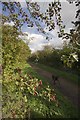
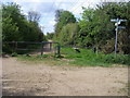
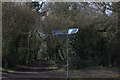
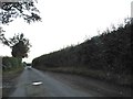
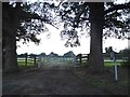
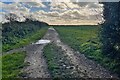
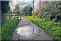
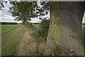
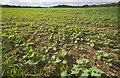
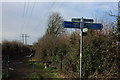
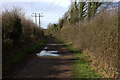
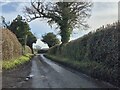
Harpenden Rural stands as a distinct civil parish within Hertfordshire, covering an area of 9.2 square kilometres. You are purchasing into a space defined by early agricultural roots and a dramatic transformation in the nineteenth century. The name itself, derived from Roman times, describes a military path through a valley, a physical reality that still shapes the modern layout. Following the division from Harpenden Urban in 1898, this settlement retained its village character despite significant expansion after the railway arrived in the 1860s. You will find the area sits on the dip slope of the Chiltern Hills, astride three valleys that run northwest to southeast. Daily life here revolves around a legacy of clean air and healthy living conditions that drove residential growth from the 1880s onwards. The trade of straw-plaiting and bleaching once thrived locally, but the discovery of good air quality combined with improved rail links to London and other towns became the primary economic driver. You live in a community where the town centre remains affectionately known as "the village", a testament to its enduring identity. Historical landmarks like St Nicholas Church, rebuilt in 1863, and Rothamsted Experimental Station, founded in 1843, mark the human history of the land. The A1081 now follows the route of the original Roman road, connecting you to St Albans, Luton, and Bedford. This mix of ancient history and nineteenth-century development creates a settlement that feels both established and connected.
- Area Type
- County Electoral Division
- Area Size
- 9.2 km²
- Population
- Not available
- Population Density
- Not available
Demographics
The community in Harpenden Rural presents a clear demographic profile, with the median age recorded at 70. This high median age indicates that you are moving into an area predominantly occupied by older residents. The population structure suggests a settlement where younger families are less common compared to nearby urban centres. You will live in an environment where the average age of your neighbours is significantly higher than the national norm. This age profile often correlates with a quieter atmosphere and different social expectations than a typical suburban housing estate. Home ownership stands at 92 per cent within the civil parish. This exceptionally high figure means that the vast majority of people in Harpenden Rural live in their own properties rather than renting. When you buy here, you are joining a market dominated by individuals with settled roots and long-term tenure. The data shows total household composition and total accommodation type without specifying minority breakdowns, but the high ownership rate defines the social fabric. You will deal with a community where property is often treated as a legacy asset. This demographic reality influences local politics, service usage, and the pace of development. You should expect a mature neighbourhood rather than a rapidly changing student or young professional hub. The 92 per cent ownership rate is a concrete fact that shapes every aspect of daily life, from local council meetings to shared community values.
Household Size
Accommodation Type
Tenure
Ethnic Group
Religion
Household Composition
Age
Household Deprivation
NS-SEC
Explore more demographic insights in this area
Go to Demographics tabPlanning
Planning Constraints
- Flood RiskPremium
- Ramsar Wetland SitesPremium
- Area of Outstanding Natural BeautyPremium
- Protected Nature ReservePremium
- Protected WoodlandPremium
- Crime RiskPremium