Area Overview for Harpenden East Ward
Photos of Harpenden East Ward
Area Information
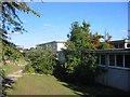
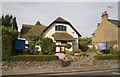
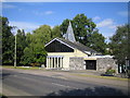
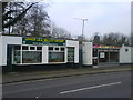
Harpenden East Ward is a compact residential district covering just 2.7 km² within the Greater London area of England. Despite its modest size, this ward offers a distinct lifestyle character that attracts both long-term residents and those seeking permanent homes. The land is densely focused on habitation rather than open countryside, ensuring a convenient walkable environment for daily needs. When considering living in Harpenden East Ward, you will find a setting defined by high land values and a mature community infrastructure. The area functions as a self-contained unit where proximity to services is maximised by a small footprint. This compactness means that essential amenities are likely within short walking or cycling distances for most households. The ward type classification indicates it is a formal administrative division within the local borough structure, governed by specific planning and community rules. Prospective buyers should appreciate that the physical scale of 2.7 km² creates an intimate neighbourhood feel, distinct from the sprawling expansion of larger towns. The concentration of residents in such a small area results in a high density of amenities per square kilometre. When you research Harpenden East Ward, you are looking at a mature, established pocket of housing that prioritises established neighbourhood dynamics over rapid development. The village-like atmosphere is reinforced by the geographical constraints that define its borders.
- Area Type
- District Borough Unitary Ward
- Area Size
- 2.7 km²
- Population
- Not available
- Population Density
- Not available
Demographics
The community profile of Harpenden East Ward reflects a settled population with a significant proportion of older residents. The median age across the ward stands at 70 years, indicating a demographic skewed heavily towards retirement age and mature adults. This age distribution suggests a neighbourhood where quiet, stability, and established routines are the norm. When you look at who lives in Harpenden East Ward, the most common age grouping encompasses the total population data provided, which underscores this overarching age trend. Home ownership represents the dominant financial arrangement within the area, with 72% of residents owning their property outright or with a mortgage. This high ownership rate contrasts sharply with rental markets and points to an established community where people have lived in these homes for extended periods. The ward shows no major breaks in household composition data, presenting a unified picture of domestic life. Accommodation types are classified by the total population count, revealing a consistent pattern of housing suited to an older demographic. While specific details on predominant ethnic groups or religious affiliations are recorded under total statistics, the narrative is clearly one of a mature, predominantly owner-occupied community. The absence of young families or transient populations in the primary data points to a stable social environment. Living in Harpenden East Ward means joining a cohort where elderly residents and their descendants form the core social fabric. This demographic reality influences local services, social clubs, and community engagement activities.
Household Size
Accommodation Type
Tenure
Ethnic Group
Religion
Household Composition
Age
Household Deprivation
NS-SEC
Explore more demographic insights in this area
Go to Demographics tabPlanning
Planning Constraints
- Flood RiskPremium
- Ramsar Wetland SitesPremium
- Area of Outstanding Natural BeautyPremium
- Protected Nature ReservePremium
- Protected WoodlandPremium
- Crime RiskPremium