Area Overview for Harling
Photos of Harling


Area Information
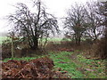
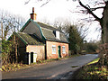
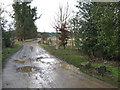
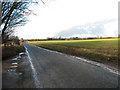
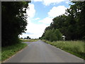
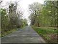
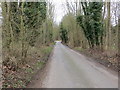
Living in Harling means settling into a civil parish that spans 23.2 square kilometres within the English countryside. This area offers a defined boundary for residents rather than the expansion found in larger urban towns. The setting involves quiet roads and open spaces, suitable for those who prefer a rural lifestyle over city chaos. Daily life here revolves around local amenities within the parish limits, without the congestion of bigger settlements. You will find a community where distances are manageable on foot or by short car journeys. The scale of the location influences your routine, creating a pace that prioritises relaxation. Homes in Harling sit within this established framework, providing stability for long-term residence. The area attracts people seeking a straightforward connection to the land. Your morning commute and evening relaxation happen within a distinct, unchanging landscape. This parity between nature and built environment defines the overall character of the parish.
- Area Type
- Parish
- Area Size
- 23.2 km²
- Population
- Not available
- Population Density
- Not available
Demographics
The community in Harling features a distinctly mature population, defined by a median age of 70 years. This figure signals a retirement-focused settlement rather than a family-centered hub. Most residents fall into the senior age bracket, shaping the social dynamics and available services. House ownership stands at 75%, which is significantly higher than the national average. This high rate indicates a stable population where people have invested in their properties. Homeowners tend to stay longer in one location, reinforcing the quiet atmosphere you will experience. The demographics suggest a low turnover rate of residents. Families with young children are not the predominant group, which may impact local school usage patterns. The settlement caters primarily to those who have downsized or moved away from busy urban centres. This age skew means you should expect neighbours who value peace and established routines. When considering homes in Harling, factor in a demographic environment dominated by older adults.
Household Size
Accommodation Type
Tenure
Ethnic Group
Religion
Household Composition
Age
Household Deprivation
NS-SEC
Explore more demographic insights in this area
Go to Demographics tabPlanning
Planning Constraints
- Flood RiskPremium
- Ramsar Wetland SitesPremium
- Area of Outstanding Natural BeautyPremium
- Protected Nature ReservePremium
- Crime RiskPremium