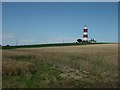
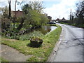
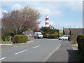
Area Overview for Happisburgh
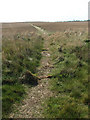
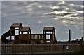
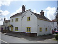
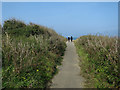
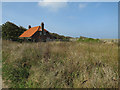
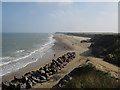
Photos of Happisburgh

Area Information
Living in Happisburgh offers a distinct blend of small-town character and practical amenities. Situated in England, this built-up area spans 29.4 hectares, creating a compact yet well-defined community. The median age of 70 suggests a population skewed towards older residents, which shapes the local atmosphere and social dynamics. Home ownership here is high, with 74% of properties owner-occupied, indicating a stable and long-term resident base. Daily life is punctuated by the presence of two primary schools, Happisburgh CofE VA Primary School and Happisburgh Church of England Primary Academy, which serve the local family demographic. While the area is small, it is connected to nearby towns via rail services, with North Walsham and Worstead stations providing access to broader networks. For those seeking a quiet, established community with essential services within reach, Happisburgh presents a straightforward option, though its size and age profile mean it is not a high-growth or youthful area.
- Area Type
- Built Up Area 250
- Area Size
- 29.4 hectares
- Population
- Not available
- Population Density
- Not available
Residents of Happisburgh have access to a range of nearby amenities that support daily life. The retail sector includes five shops, with notable names such as Tesco Norwich, Morrisons Daily, and Sainsburys North, offering convenience for grocery shopping and other essentials. The two rail stations, North Walsham and Worstead, provide connectivity to larger towns and cities, though the distance may influence how frequently they are used. While the area lacks detailed information on parks or leisure facilities, the presence of retail and rail options suggests a practical approach to community living. The compact size of Happisburgh means amenities are within walking or short driving distance, contributing to a low-maintenance lifestyle.
Amenities
Schools
Happisburgh is served by two primary schools: Happisburgh CofE VA Primary School and Happisburgh Church of England Primary Academy. Both institutions cater to the local community, providing education for younger residents. The presence of two primary schools suggests a focus on early education, though no Ofsted ratings or academic performance data are available in the provided information. Families with children benefit from having nearby schools, though the absence of secondary education options within the area may require commuting to larger towns. The schools’ names indicate a religious affiliation, which may align with the broader demographic profile of the area.
| Rank | School | Type | Entry gender | Ages |
|---|
Explore more schools in this area
Go to Schools tabDemographics
Happisburgh’s population is defined by a median age of 70, reflecting a community predominantly composed of older residents. The most common age range is listed as “Age: Total,” suggesting limited variation in demographics. Home ownership stands at 74%, a figure that underscores the area’s reliance on owner-occupied properties rather than rental housing. The data does not specify household composition or accommodation types, but the high home ownership rate implies a settled, long-term population. Ethnicity and religion are also reported as “Total,” meaning no breakdowns are available for diversity metrics. This lack of granularity means the community’s cultural or religious composition remains unclear. The absence of detailed data on deprivation or economic factors leaves questions about quality of life unaddressed, though the low crime risk suggests a generally safe environment.
Household Size
Accommodation Type
Tenure
Ethnic Group
Religion
Household Composition
Age
Household Deprivation
NS-SEC
Explore more demographic insights in this area
Go to Demographics tabPlanning
Planning Constraints
- Crime RiskPremium