Area Overview for Handside Ward
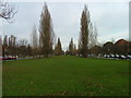
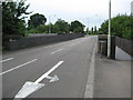
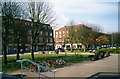
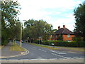
Photos of Handside Ward


Area Information
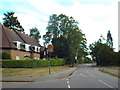
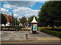
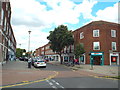
Living in Handside Ward offers a distinct experience within the Welwyn Hatfield district of Hertfordshire. This compact ward covers just 3.6 square kilometres, creating a tightly knit community where neighbours often know one another. You will find a quiet residential atmosphere here, separate from the busier commercial hubs of the wider district. With 1,758 residents calling this area home, the ward maintains a low population density of 486 people per square kilometre. These figures suggest a neighbourhood where space is plentiful and daily life moves at a measured pace. The area functions as a well-defined local authority unit within the East of England region. Profiled as a district borough unitary ward, Handside lacks the historical landmarks or notable features typical of larger ancient settlements. Its character is defined by its size and location rather than grand monuments or extensive industrial history. Residents here enjoy the benefits of a smaller community without being isolated from the services provided by the Welwyn Hatfield local authority. Whether you look for a private studio or a larger family home, you will find options within this substantial but geographically contained space. The ward represents a practical choice for those seeking a settled lifestyle in a recognised administrative area.
- Area Type
- District Borough Unitary Ward
- Area Size
- 3.6 km²
- Population
- 1758
- Population Density
- 486 people/km²
Demographics
The community profile of Handside Ward is defined by a notably older demographic than the national average. With a median age of 70 years, this ward serves as a primary retirement location. The population consists primarily of residents in older age brackets, reflecting a stable and established community structure. You will find that the average household here comprises people who have lived in their homes for many years, contributing to the area's low turnover rate. This age profile influences local amenities and social activities, prioritising services suited to an elderly population rather than young families or students. Home ownership is the dominant tenure in Handside Ward, with 65 per cent of residents owning their property outright or with a mortgage. This high level of ownership underscores the area's status as a place where people settle down for the long term rather than viewing homes as temporary rentals. The ward functions as a traditional neighbourhood where stability is the norm. While specific data on household composition types such as singles or couples is not detailed in the available records, the high ownership rate strongly implies multi-generational stability. The community composition reflects a predictable pattern typical of mature English districts, offering continuity and familiar surroundings for those looking to retire or downsize.
Household Size
Accommodation Type
Tenure
Ethnic Group
Religion
Household Composition
Age
Household Deprivation
NS-SEC
Explore more demographic insights in this area
Go to Demographics tabPlanning
Planning Constraints
- Flood RiskPremium
- Ramsar Wetland SitesPremium
- Area of Outstanding Natural BeautyPremium
- Protected Nature ReservePremium
- Protected WoodlandPremium
- Crime RiskPremium