Area Overview for Hadleigh South Ward
Photos of Hadleigh South Ward


Area Information
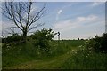
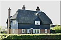
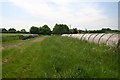
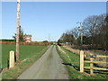
Living in Hadleigh South Ward offers a distinct experience within the larger market town of Hadleigh. This electoral ward forms a specific part of Babergh District in Suffolk, situated in Eastern England. You are looking at a relatively compact area covering just 9.9 square kilometres. Despite its small size, it accommodates a resident population of 1,121 people. This results in a population density of 113 people per square kilometre, which suggests a quiet residential feel rather than a high-density urban environment. The ward sits at coordinates 52.0406°N, 0.9795°E, firmly placing it within the rural-urban fringe characterised by the wider Hadleigh community. Daily life here is shaped by this modest scale and its integration into the town of Hadleigh, which supports a population of around 7,000. The area functions as a sub-segment of this larger locality, benefiting from the amenities of the main town while maintaining its own administrative boundaries under the Babergh District Council. For those considering homes in Hadleigh South Ward, the minor footprint means you are not dealing with sprawling suburbs but a concentrated neighbourhood. The demographic profile points towards an older community, with a median age of 70. This indicates a settled population likely valuing stability and established local connections over rapid development or transient lifestyles. The region operates under the established governance of Hadleigh and Suffolk, enjoying the structural support of the county and district councils. Opportunities for education and health services rely on the surrounding infrastructure provided for the Hadleigh town centre. Understanding the specific nature of Hadleigh South Ward is essential before committing to a property here, as the small population and defined geographic boundaries create a very specific living context.
- Area Type
- District Borough Unitary Ward
- Area Size
- 9.9 km²
- Population
- 1121
- Population Density
- 113 people/km²
Demographics
The community within Hadleigh South Ward is defined by a pronounced age profile. The median age stands at 70, indicating that a significant portion of the population consists of older residents. This creates a demographic landscape where fewer young families might reside compared to other regions. You are looking at an area dominated by the mature age group, which shapes the rhythm of neighbourhood interactions and community activities. Data confirms that the most common age range corresponds to the total population measure, reinforcing this older average without specific percentage breakdowns for younger cohorts. Home ownership is a dominant feature of life in this ward. Exactly 65% of households own their homes outright or with a mortgage. This relatively high ownership rate suggests a stable, long-term community where residents have put down roots. The remaining 35% of the population comprises tenants or other living arrangements, though the specific split between private and social renting is not detailed in the available figures. Households in Hadleigh South Ward also appear to be largely owner-occupied based on this statistic. Accommodation types, household composition, predominant ethnic groups, and religious affiliations are recorded in the dataset but no specific breakdowns are provided for these categories. Consequently, the primary demographic insight remains the age structure and ownership levels. This focus on the senior population and high ownership rates offers a clear picture of who lives here. You are likely dealing with a cohort that values security and has already transitioned from those seeking new tenure. The age profile means local facilities and social events may cater specifically to an older demographic, which is a key factor to consider when evaluating quality of life.
Household Size
Accommodation Type
Tenure
Ethnic Group
Religion
Household Composition
Age
Household Deprivation
NS-SEC
Explore more demographic insights in this area
Go to Demographics tabPlanning
Planning Constraints
- Flood RiskPremium
- Ramsar Wetland SitesPremium
- Area of Outstanding Natural BeautyPremium
- Protected Nature ReservePremium
- Protected WoodlandPremium
- Crime RiskPremium