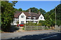
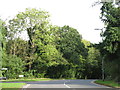
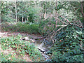
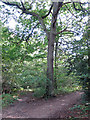
Area Overview for HA6 3HP
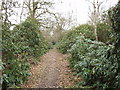
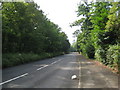
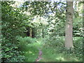
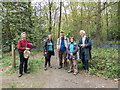
Photos of HA6 3HP


Area Information
HA6 3HP is a compact residential postcode in England, home to 1,808 people spread across a densely populated area of 1.05 km². This small cluster of homes is characterised by its mature demographic, with a median age of 47 and a majority of residents aged 30–64. The area’s tight-knit nature means amenities and services are closely grouped, making daily life convenient. Residents benefit from a low crime risk, with a safety score of 91, and no significant environmental hazards like flood zones or protected natural sites. The postcode is served by a range of local shops, including Waitrose Northwood and Tesco Northwood, and is within reach of multiple rail and metro stations, ensuring easy access to nearby towns. For families, Eastbury Farm Primary School, rated ‘good’ by Ofsted, provides a solid foundation for education. HA6 3HP is ideal for those seeking a stable, secure environment with a balance of local convenience and broader connectivity.
- Area Type
- Postcode
- Area Size
- Not available
- Population
- 1808
- Population Density
- 1725 people/km²
HA6 3HP is primarily an owner-occupied area, with 63% of properties owned by residents rather than rented. The accommodation type is predominantly houses, which is unusual for a small postcode but suggests a focus on family homes or larger dwellings. This mix of ownership and housing type indicates a stable market, likely attracting buyers seeking long-term residency rather than short-term investment. The compact size of the area means the property stock is limited, which could make it a competitive market for buyers. Those considering the area should note that the housing is largely traditional, with few modern developments. The proximity to rail and metro stations, along with nearby retail hubs, adds to the appeal for families and professionals seeking a balance between local convenience and broader connectivity.
House Prices in HA6 3HP
No properties found in this postcode.
Energy Efficiency in HA6 3HP
HA6 3HP offers a mix of retail, transport, and leisure options within easy reach. Local shops such as Waitrose Northwood, Cook Northwood, and Tesco Northwood provide grocery and everyday shopping needs, while the area’s proximity to rail and metro stations ensures access to broader retail and dining choices in nearby towns. The presence of multiple transport hubs, including Carpenders Park Railway Station and Moor Park Underground Station, enhances mobility for commuting or weekend excursions. Although no parks or leisure facilities are explicitly listed in the data, the compact layout suggests that residents can access green spaces or recreational areas nearby. The area’s convenience, combined with its safety and connectivity, supports a lifestyle that balances local amenities with opportunities for exploration beyond the immediate postcode.
Amenities
Schools
The primary school nearest to HA6 3HP is Eastbury Farm Primary School, which serves the local community with a ‘good’ Ofsted rating. This school is the only educational institution explicitly listed in the data, suggesting that families in the area may need to look beyond HA6 3HP for secondary education options. The presence of a well-rated primary school is a key factor for families, as it provides a foundation for early education. However, the absence of secondary schools or other educational facilities in the immediate vicinity means that parents may need to consider commuting for older children. The quality of the primary school, combined with the area’s safety and accessibility, makes it an attractive choice for those prioritising family-friendly amenities.
| Rank | School | Type | Entry gender | Ages |
|---|---|---|---|---|
| 1 | Eastbury Farm Primary School | primary | N/A | N/A |
Explore more schools in this area
Go to Schools tabDemographics
The community in HA6 3HP is predominantly composed of adults aged 30–64, with a median age of 47. This suggests a mature, established population, likely with long-term ties to the area. Homeownership rates are strong, at 63%, indicating a mix of long-term residents and those who have invested in property. The area is largely composed of houses, which aligns with the demographic profile of older, family-oriented households. The predominant ethnic group is White, with no data provided on other groups. The population density of 1,725 people per km² reflects a closely packed residential cluster, which may contribute to a sense of community but could also mean limited open space. The absence of specific data on deprivation or income levels means that quality of life is inferred from the low crime risk and availability of local amenities.
Household Size
Accommodation Type
Tenure
Ethnic Group
Religion
Household Composition
Age
Household Deprivation
NS-SEC
Explore more demographic insights in this area
Go to Demographics tabPlanning
Planning Constraints
- Flood RiskPremium
- Ramsar Wetland SitesPremium
- Area of Outstanding Natural BeautyPremium
- Protected Nature ReservePremium
- Protected WoodlandPremium
- Crime RiskPremium