Area Overview for HA6 3DY
Photos of HA6 3DY
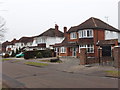
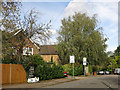

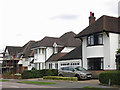
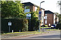
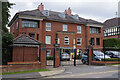
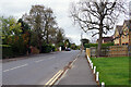
28 photos from this area
Area Information
Key information about the HA6 3DY including its size, population, and administrative classification.
- Area Type
- Postcode
- Area Size
- 2.3 hectares
- Population
- 2282
- Population Density
- 2020 people/km²
House Prices in HA6 3DY
23
Properties
£928,125
Average Sold Price
£259,500
Lowest Price
£1,825,000
Highest Price
Showing 23 properties
| Address | Type | Beds | Baths | Last Sale Price | Last Sale Date | |
|---|---|---|---|---|---|---|
| 34 The Fairway, Northwood, HA6 3DY | Detached | 5 | 2 | £1,720,000 | Aug 2025 | |
| 36 The Fairway, Northwood, HA6 3DY | Detached | 3 | 1 | £1,130,000 | Feb 2024 | |
| 30 The Fairway, Northwood, HA6 3DY | Detached | 5 | 3 | £1,625,000 | Sep 2023 | |
| 42 The Fairway, Northwood, HA6 3DY | Detached | 4 | 3 | £1,825,000 | May 2022 | |
| 44 The Fairway, Northwood, HA6 3DY | Detached | 4 | 2 | £1,125,000 | Nov 2020 | |
| 28 The Fairway, Northwood, HA6 3DY | Detached | 3 | 4 | £1,335,000 | Aug 2016 | |
| 16 The Fairway, Northwood, HA6 3DY | Detached | - | - | £512,500 | Feb 2002 | |
| 22 The Fairway, Northwood, HA6 3DY | Detached | - | - | £592,500 | Nov 2001 | |
| 40 The Fairway, Northwood, HA6 3DY | Detached | - | - | £415,000 | Oct 1999 | |
| 32 The Fairway, Northwood, HA6 3DY | Detached | - | - | £325,000 | Jul 1999 |
Page 1 of 3
Energy Efficiency in HA6 3DY
Amenities
Schools
| Rank | School | Type | Entry gender | Ages |
|---|
Explore more schools in this area
Go to Schools tabDemographics
Household Size
Family (3-5 people)
most common
Accommodation Type
Houses
most common
Tenure
88
majority
Ethnic Group
asian_total
most common
Religion
N/A
most common
Household Composition
N/A
most common
Age
47
median
Adults (30-64 years)
most common
Household Deprivation
N/A
with no deprivation
NS-SEC
59
in Lower managerial occupations
Explore more demographic insights in this area
Go to Demographics tabPlanning
Planning Constraints
- Flood RiskPremium
- Ramsar Wetland SitesPremium
- Area of Outstanding Natural BeautyPremium
- Protected Nature ReservePremium
- Protected WoodlandPremium