Area Overview for HA6 3AY
Photos of HA6 3AY
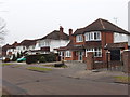
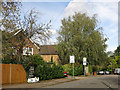

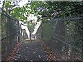
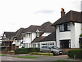
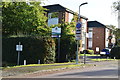
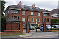
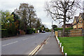
28 photos from this area
Area Information
Key information about the HA6 3AY including its size, population, and administrative classification.
- Area Type
- Postcode
- Area Size
- 3.8 hectares
- Population
- 2282
- Population Density
- 2020 people/km²
House Prices in HA6 3AY
30
Properties
£692,655
Average Sold Price
£235,000
Lowest Price
£1,175,000
Highest Price
Showing 30 properties
| Address | Type | Beds | Baths | Last Sale Price | Last Sale Date | |
|---|---|---|---|---|---|---|
| 41 St Marys Avenue, Northwood, HA6 3AY | Detached | 4 | 1 | £1,055,000 | Nov 2023 | |
| 35 St Marys Avenue, Northwood, HA6 3AY | house | - | - | £1,100,000 | Mar 2021 | |
| 31 St Marys Avenue, Northwood, HA6 3AY | Detached | 5 | 2 | £1,175,000 | Dec 2020 | |
| 17 St Marys Avenue, Northwood, HA6 3AY | Detached | 5 | 3 | £1,140,000 | Oct 2019 | |
| 53 St Marys Avenue, Northwood, HA6 3AY | Detached | 4 | 2 | £945,000 | Aug 2015 | |
| 51 St Marys Avenue, Northwood, HA6 3AY | Detached | 7 | 7 | £855,000 | Jan 2015 | |
| 25 St Marys Avenue, Northwood, HA6 3AY | house | - | - | £755,000 | Jan 2013 | |
| 33 St Marys Avenue, Northwood, HA6 3AY | Detached | 5 | 1 | £745,000 | Dec 2012 | |
| 1 St Marys Avenue, Northwood, HA6 3AY | Detached | 4 | 1 | £642,500 | Oct 2007 | |
| Coryton, 55 St Marys Avenue, Northwood, HA6 3AY | Detached | - | - | £675,000 | May 2007 |
Page 1 of 3
Energy Efficiency in HA6 3AY
Amenities
Schools
| Rank | School | Type | Entry gender | Ages |
|---|
Explore more schools in this area
Go to Schools tabDemographics
Household Size
Family (3-5 people)
most common
Accommodation Type
Houses
most common
Tenure
88
majority
Ethnic Group
asian_total
most common
Religion
N/A
most common
Household Composition
N/A
most common
Age
47
median
Adults (30-64 years)
most common
Household Deprivation
N/A
with no deprivation
NS-SEC
59
in Lower managerial occupations
Explore more demographic insights in this area
Go to Demographics tabPlanning
Planning Constraints
- Flood RiskPremium
- Ramsar Wetland SitesPremium
- Area of Outstanding Natural BeautyPremium
- Protected Nature ReservePremium
- Protected WoodlandPremium