Area Overview for Griston
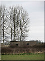
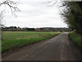
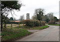
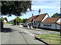
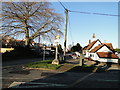
Photos of Griston
Area Information
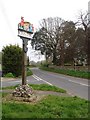
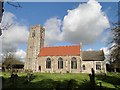
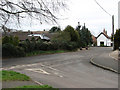
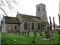
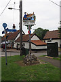
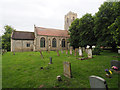
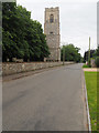
Griston is a built-up village and civil parish situated in the Wayland area of the Breckland district in Norfolk. The settlement covers 56.4 hectares and sits approximately two miles south-east of Watton. This location places residents within the East of England region, offering a quiet country setting while maintaining proximity to a larger town. The area carries significant historical weight, having been first mentioned in the Domesday Book. Historical records suggest the name derives from a farm or settlement, possibly linked to the concept of a young pig. Local folklore attaches Griston Hall to the classic tale of the Babes in the Wood, a story immortalised on the village sign. The village sign depicts the fictional wicked uncle whose orders brought down legend upon the area. Living in Griston means accessing a community with deep roots, currently reflected in a population of 1,364 recorded in 2021. The village features landmarks such as St Martin's Church and Wayland Wood, which surround the historic Griston Hall. Residents enjoy the character of a traditional Norfolk village with established institutions and green spaces. There are designated pubs including The Old Bell and The Eagle providing local gathering points. Transport links rely on road networks, with the nearest railway station located roughly 7.5 miles away at Harling Road. The post town for the area is Watton under Thetford, streamlining postal and administrative correspondence. Homes in Griston reflect the village's age and history, contributing to a distinct residential atmosphere separate from the larger urban centres nearby.
- Area Type
- Built Up Area 250
- Area Size
- 56.4 hectares
- Population
- Not available
- Population Density
- Not available
Daily life in Griston centres on local amenities located within practical reach of residents. There are four key retail locations nearby, providing essential shopping options without needing a drive to a larger town. Specific venues include Spar, Lidl Watton, and Tesco Watton. These supermarkets offer a range of grocery needs, allowing you to stock up on household essentials and food staples. The village sign and village hall, though not explicitly named in the shopping list, anchor the lifestyle around community events and history. Heritage sites like Griston Hall and Wayland Wood offer leisure opportunities outside of shopping trips. Local pubs such as The Old Bell and The Eagle provide social spaces for meeting neighbours and enjoying meals. Religious and historical life is anchored by St Martin's Church, which serves as a community focal point. The proximity to Watton ensures thatlarger leisure facilities, cinema, and specialist shopping centres are accessible by car. The 56.4 hectares of built area include the open spaces that define the village feel. You will find that living in Griston requires a car for most activities beyond the immediate radius where the four key retail outlets sit. The unnamed Domesday history and the Babes in the Wood folklore give the village a unique narrative that shapes local character. Amenities like the Spar and Lidl are sufficient for weekly needs, while the historic nature of the village attracts those who value tradition over modern convenience.
Amenities
Schools
| Rank | School | Type | Entry gender | Ages |
|---|
Explore more schools in this area
Go to Schools tabDemographics
The community within Griston reflects a settled population with a distinct age profile. The median age for residents is 70, indicating a demographic skew significantly towards older adults compared to the national average. This age composition suggests the area attracts retirees or those seeking a quieter life away from bustling cities. The most common age bracket is recorded as 'Age: Total', meaning the full demographic spread is available for analysis without gaps. House ownership stands at 58%, a figure that indicates just over half of the households possess their properties outright. This majority suggests a stable community where many families have remained in the area for long periods. Diversity and household composition are noted as being recorded in the total category, providing a complete picture of how people live in the village. The predominant ethnic group and religious affiliations are also recorded in the total category, offering clear data on the social fabric of the parish. With only 6.8% of the population estimated to be in under-40 age brackets, you should expect a village atmosphere where neighbours often know each other well. This demographic reality shapes local services and schools, which cater to a community needing care and leisure facilities rather than hundreds of young families. The home ownership rate of 58% means a substantial portion of residents have long-term ties to their homes. This stability contributes to the quiet character of the village, with fewer transient residents moving in and out frequently.