Area Overview for Gresham
Photos of Gresham
Area Information
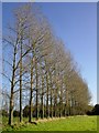
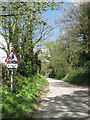
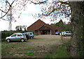
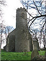
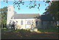
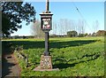
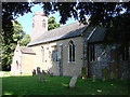
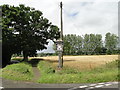
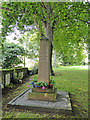
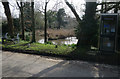
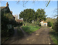
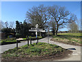
Gresham is a built-up area covering 23.7 hectares within the Norfolk Coast district of North Norfolk. Located approximately five miles north of Holt and twenty miles north-west of Norwich, it sits near villages such as Bessingham and East Beckham. The landscape is defined by its rural setting, with the area's name derived from the local Gur Beck stream. Historical records from the Domesday Book of 1086 identify the settlement as a holding of William dearenne, 1st Earl of Surrey. A significant landmark is the 14th-century moated fortified manor house, known as Gresham Castle, which was constructed in 1318 by Sir Edmund Bacon. The district also contains the village hall and The Wheatsheaf pub, alongside the medieval All Saints Church with its distinctive round tower. This location appeals to those seeking a peaceful environment surrounded by countryside suitable for walking and cycling via a network of footpaths and bridleways. Regular community events, including a summer fete and a Christmas market, reinforce the local atmosphere. What matters most for residents is the proximity to local amenities and the quiet character of the parish itself.
- Area Type
- Built Up Area 250
- Area Size
- 23.7 hectares
- Population
- Not available
- Population Density
- Not available
Daily life in Gresham revolves around a cluster of amenities within a short drive. You have access to five notable retail locations, including Tesco Sheringham, Budgens Sheringham, and Sainsburys Sheringham, which cover most daily shopping needs. For rail travel, five stations fall within practical reach, with West Runton Railway Station being the closest at 2.73 miles, followed by Sheringham Railway Station at 2.92 miles. Two metro-style transport nodes near Weybourne and Holt serve as local interchange points. The village features The Wheatsheaf pub as a central social hub, providing a focal point for community gatherings. Leisure activities centre on the extensive network of footpaths and bridleways that thread through the beautiful countryside surrounding the parish. The area hosts a summer fete and a Christmas market throughout the year. There is also a village hall available for local events and meetings. While specific leisure centres or hospitals are not listed, the proximity to Holt and Sheringham ensures broader access to larger facilities. This layout supports independent living with minimal reliance on city centres for routine tasks.
Amenities
Schools
| Rank | School | Type | Entry gender | Ages |
|---|
Explore more schools in this area
Go to Schools tabDemographics
The community in Gresham reflects a mature population with a median age of seventy. This age profile indicates a neighbourhood where residents are likely retired or approaching retirement. Nearly three-quarters of the area consists of owner-occupied homes, as home ownership stands at seventy-three per cent for households. The total population composition includes all age ranges, though the demographic data highlights older age groups as the most common. Details regarding predominant ethnic groups, religion, and specific household compositions are not available in the current records. The high rate of home ownership suggests many families have downsized or settled permanently in this rural setting away from urban centres. Because the median age is so high, the surroundings cater to those with established routines rather than young families moving for work. You will find a stable group of people who know the local bridleways and the history of the neighbouring Gresham Castle. The community feel is likely quiet and familiar, reflecting the long-term presence of these residents in the parish.
Household Size
Accommodation Type
Tenure
Ethnic Group
Religion
Household Composition
Age
Household Deprivation
NS-SEC
Explore more demographic insights in this area
Go to Demographics tabPlanning
Planning Constraints
- Crime RiskPremium