Area Overview for Great Waltham
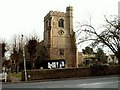
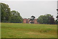
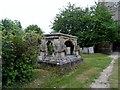
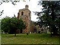
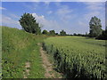
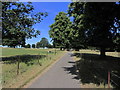
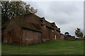
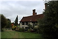
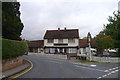
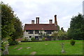
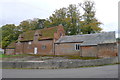
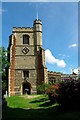
Photos of Great Waltham
Area Information
Great Waltham is a compact built-up area spanning 28 hectares, situated in England. Its population, while not explicitly quantified, is reflected in its median age of 70, indicating a community skewed toward older residents. This area offers a blend of practical living with proximity to essential services. The presence of a Church of England primary school with a good Ofsted rating underscores the focus on education, while nearby rail stations at Chelmsford and Hatfield Peverel provide reliable transport links. Daily life here is shaped by the area’s size, which fosters a close-knit environment, and its infrastructure, including retail options like M&S Broomfield and Morrisons Chelmsford. With a crime risk score of 70, which is below average, Great Waltham presents a safer living environment. The area’s appeal lies in its balance of accessibility, safety, and the availability of amenities that cater to both everyday needs and broader connectivity.
- Area Type
- Built Up Area 250
- Area Size
- 28.0 hectares
- Population
- Not available
- Population Density
- Not available
Great Waltham’s lifestyle is shaped by its proximity to retail and transport hubs. The area’s immediate vicinity includes notable retail venues such as M&S Broomfield, Waitrose Little, and Morrisons Chelmsford, offering a range of shopping options. These stores cater to everyday needs, from groceries to clothing, enhancing convenience for residents. The presence of two nearby railway stations ensures easy access to larger urban centres, supporting both commuting and leisure travel. While the area’s small size limits extensive leisure facilities, the availability of nearby shops and transport links contributes to a practical, community-focused lifestyle. The balance of accessibility and local amenities makes daily life in Great Waltham efficient and well-supported.
Amenities
Schools
The nearest school to Great Waltham is the Great Waltham Church of England Voluntary Controlled Primary School, which serves the local community with a good Ofsted rating. This primary school is a key asset for families, offering a solid foundation for early education. The absence of secondary schools in the immediate vicinity means families may need to look further afield for secondary education, though the primary school’s quality ensures a strong start for children. The presence of a single primary school with a good rating reflects the area’s focus on accessible, high-standard education for younger residents, though it also highlights the need for planning when considering long-term family needs.
| Rank | A + A* % | School | Type | Entry gender | Ages |
|---|---|---|---|---|---|
| 1 | N/A | Great Waltham Church of England Voluntary Controlled Primary School | primary | N/A | N/A |
Explore more schools in this area
Go to Schools tabDemographics
The population of Great Waltham has a median age of 70, with the most common age range encompassing all age groups. This suggests a community where older residents form a significant portion. Home ownership is high, at 75%, indicating a strong presence of owner-occupied properties. The accommodation types and household composition data are not specified, but the overall demographic profile points to a mature population. The area’s predominantly older demographic may influence local services and community dynamics, though specific data on diversity or deprivation is not available. This age profile could mean a quieter, more stable environment, though it also highlights the need for age-appropriate infrastructure and healthcare access.
Household Size
Accommodation Type
Tenure
Ethnic Group
Religion
Household Composition
Age
Household Deprivation
NS-SEC
Explore more demographic insights in this area
Go to Demographics tabPlanning
Planning Constraints
- Crime RiskLocked