Area Overview for Great Thurlow
Photos of Great Thurlow
Area Information
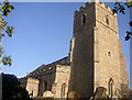
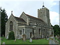
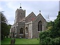
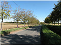
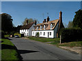
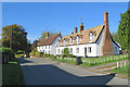
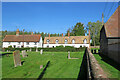
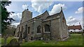
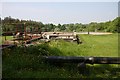
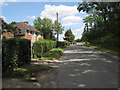
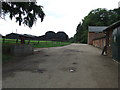
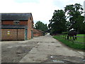
Great Thurlow is a civil parish located in the West Suffolk district of Suffolk, situated in the far south-west of the county near the borders with Cambridgeshire and Essex. This village occupies an area of 8.3 km² and is defined by its rural character stemming from a history as a royal holding. Historical records from the Domesday Book of 1086 confirm the presence of arable land, meadow, woodland, and a church at that time. The settlement has maintained its identity through centuries of change, transitioning from medieval manors under the Pecche family to Georgian and Victorian development led by the Soame and Vernon families. You will find significant historical landmarks, including All Saints Church and Almshouses founded around 1614 by Sir Stephen Soame. The area also features restored buildings such as Great Thurlow Hall and structures linked to Collis Mill. Daily life here revolves around local institutions like the Cock Inn and the former Congregational Chapel, which now serves as a private house. Residents enjoy a connection to the past, with Temple End manor remaining a point of local interest. Living in Great Thurlow means embracing a community rooted in centuries of agricultural and estate history while maintaining proximity to neighbouring parishes like Little Thurlow.
- Area Type
- Parish
- Area Size
- 8.3 km²
- Population
- Not available
- Population Density
- Not available
Demographics
The community in Great Thurlow presents a distinct age profile with a median age of 70 years. The provided demographic data categorises the total population under the most common age range label without breaking down specific adult, child, or senior percentages. However, the high median age suggests a settlement predominantly populated by older residents, likely reflecting the area's rural nature and limited young family growth. Home ownership stands at 70%, indicating that the majority of households in Great Thurlow purchase their properties rather than renting. This high rate implies stability for many local families who have stayed across generations. The data does not provide specific figures for household composition beyond the label 'total' or predominant ethnic groups. Consequently, you cannot determine the exact diversity of ethnicities or religious affiliations from the available statistics. Instead, the 70% ownership rate remains the most concrete indicator of community structure. This level of ownership often facilitates tighter social networks within small parishes.
Household Size
Accommodation Type
Tenure
Ethnic Group
Religion
Household Composition
Age
Household Deprivation
NS-SEC
Explore more demographic insights in this area
Go to Demographics tabPlanning
Planning Constraints
- Flood RiskPremium
- Ramsar Wetland SitesPremium
- Area of Outstanding Natural BeautyPremium
- Protected Nature ReservePremium
- Protected WoodlandPremium