Area Overview for Great Snoring
Photos of Great Snoring


Area Information
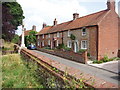
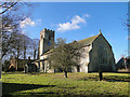
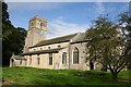
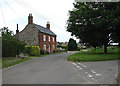
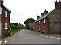
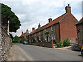
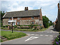
Living in Great Snoring offers a distinctly quiet rural experience within English countryside. This civil parish covers an area of 6.8 square kilometres, providing a manageable footprint for those seeking a low-key lifestyle away from urban commotion. The location sits in a peaceful setting where daily life revolves around local neighbourhoods rather than major commercial hubs. Residents here enjoy a sense of isolation that appeals to retirees and remote workers who value space over convenience. The small scale of the parish means that distances between homes are short, fostering a tight-knit community atmosphere. You can explore the entire landscape on foot or by bike within a reasonable timeframe. Great Snoring does not feature large development sites or industrial zones, ensuring the built environment remains subordinate to the natural surroundings. This simplicity defines the character of homes in Great Snoring. When you move here, you trade city amenities for tranquillity. The area functions as a serene retreat where the pace of life is inherently slower. Your mornings begin without the roar of traffic, and your evenings settle into a calm routine.
- Area Type
- Parish
- Area Size
- 6.8 km²
- Population
- Not available
- Population Density
- Not available
Demographics
The community profile of Great Snoring reflects a settlement designed for mature residents rather than young families or students. The median age for the population stands at 70 years old, indicating that senior citizens form the core of your neighbours. This high concentration of older adults shapes the local culture and demand for specific services like healthcare and leisure facilities appropriate for late-life living. Household composition and accommodation type statistics confirm that the area caters primarily to this demographic. Home ownership reaches 55 per cent of the total population, suggesting a settled community where families plan to remain for the long term. This high rate of ownership often correlates with stability and longer-term maintenance of properties. Ethnic diversity and religious affiliation data are too general to indicate distinct cultural pockets within the parish. The lack of a defined dominant ethnic group or specific religious majority points to a homogenous, traditional village population. You will find a neighbourhood where social interactions are driven by shared history and common age-related stages of life rather than multicultural diversity.
Household Size
Accommodation Type
Tenure
Ethnic Group
Religion
Household Composition
Age
Household Deprivation
NS-SEC
Explore more demographic insights in this area
Go to Demographics tabPlanning
Planning Constraints
- Flood RiskLocked
- Ramsar Wetland SitesLocked
- Area of Outstanding Natural BeautyLocked
- Protected Nature ReserveLocked
- Protected WoodlandLocked
- Crime RiskLocked