Area Overview for Great Shelford
Photos of Great Shelford


Area Information
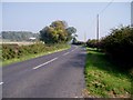
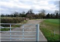
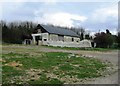
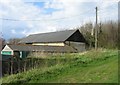
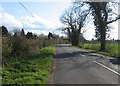
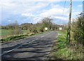
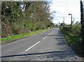
Great Shelford is a civil parish situated 6.4 km south of Cambridge, covering a total area of 8.4 km². The village is defined by its historic settlement around a ford over the River Cam and a subsidiary hamlet at Granham's Farm. You will find that the community evolved from medieval origins to become a significant commuter village for Cambridge University academics and middle-class residents. The population has grown substantially from 803 in 1841 to 4,233 in 2011, solidifying its status as a well-established neighbourhood within Cambridgeshire. Daily life here centres on the historic High Street, which runs alongside the famous St Mary the Virgin Church built in 1387. The Great Shelford Conservation Area protects the core around High Green and the early medieval settlement foci, ensuring the historic character remains intact. A water mill established in 1251 still stands as a testament to the area's agricultural past. You have easy access to transport via the Great Eastern railway line, with a station opened in 1845 offering a short journey to both Cambridge and London Liverpool Street. Living in Great Shelford means residing in a location that balances rich history with modern commuter convenience, anchored by landmarks like the Manor House first recorded in 1321.
- Area Type
- Parish
- Area Size
- 8.4 km²
- Population
- Not available
- Population Density
- Not available
Demographics
The community in Great Shelford displays a distinct age profile with a median age of 70 years. This higher median suggests the population leans towards older demographics compared to many urban centres. Most common household compositions and accommodation types are recorded under total categories, providing a comprehensive view of how residents organise their living spaces. Home ownership stands at a notable 66%, indicating that the majority of households in the parish own their properties outright or with a mortgage. This high level of ownership contrasts with the national average where rental markets are more prevalent. The area was classified as Britain's twenty-second richest village in 2011, a statistic that aligns with the strong home ownership rates. You will not find significant data on predominant ethnic groups or specific religious breakdowns in the current records, but the socioeconomic status suggests a stable and established residential base. For buyers, this demographic profile points to a quiet, settled community rather than a transient student environment. The ageing population often correlates with lower household energies and a preference for established, larger homes found in conservation areas.
Household Size
Accommodation Type
Tenure
Ethnic Group
Religion
Household Composition
Age
Household Deprivation
NS-SEC
Explore more demographic insights in this area
Go to Demographics tabPlanning
Planning Constraints
- Flood RiskPremium
- Ramsar Wetland SitesPremium
- Area of Outstanding Natural BeautyPremium
- Protected Nature ReservePremium
- Protected WoodlandPremium
- Crime RiskPremium