Area Overview for Great Glemham
Photos of Great Glemham

Area Information
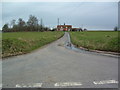
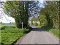
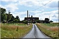
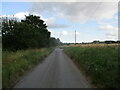
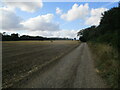
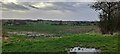
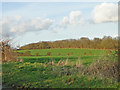
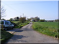
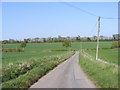
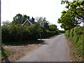
Great Glemham is a civil parish situated in England, covering an area of 7.8 square kilometres. Living in Great Glemham means residing in a small, contained community where daily life moves at a more deliberate pace. The settlement functions as a self-contained entity, typical of the surrounding countryside where distance between key points is short. You will find that the geography is defined by its rural character, offering immediate access to open spaces while maintaining a distinct separation from larger urban centres. This limited footprint often results in close proximity between residential properties and local amenities. When considering Great Glemham, you are looking at a location where the boundary between nature and home is minimal. The scale of the area ensures that you can traverse the full extent of the parish without travelling far. This compact nature influences how residents interact with their environment and each other. Life here is characterised by a quiet rhythm determined by the local topography and seasonal changes. If you seek a home in Great Glemham, you join a population that values the stability associated with a defined geographical boundary. The identity of the area remains firmly rooted in its status as a rural parish within the wider county.
- Area Type
- Parish
- Area Size
- 7.8 km²
- Population
- Not available
- Population Density
- Not available
Demographics
The community in Great Glemham is distinguished by its mature population profile, with a median age of 70 years. This figure indicates that the area is home to a significant number of older residents who have likely lived in the parish for decades. Most households consist of individuals or couples with established families or grown-up children, reflecting a demographic shift towards older age groups. You will discover that 70 per cent of the area is owner-occupied, suggesting a community deeply invested in the long-term property values of Great Glemham. This high level of home ownership typically corresponds with residents who have purchased their homes decades ago or inherited property within the parish. The accommodation mix supports this demographic, providing environments suitable for retirement or later-life living. Diversity in terms of ethnicity and religion does not appear as a defining feature of the current census data, which points to a settled, longstanding population. The household composition reflects a lower rate of single parents or young families compared to more urbanised districts. When choosing to live in Great Glemham, you join a group of people for whom the village is often a permanent home rather than a temporary residence. The age structure means that local services cater primarily to the needs of older adults, shaping the daily rhythm of the neighbourhood.
Household Size
Accommodation Type
Tenure
Ethnic Group
Religion
Household Composition
Age
Household Deprivation
NS-SEC
Explore more demographic insights in this area
Go to Demographics tabPlanning
Planning Constraints
- Flood RiskPremium
- Ramsar Wetland SitesPremium
- Area of Outstanding Natural BeautyPremium
- Protected Nature ReservePremium
- Protected WoodlandPremium
- Crime RiskPremium