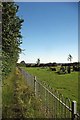
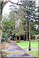
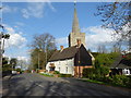
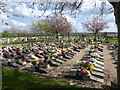
Area Overview for Great Burstead and South Green
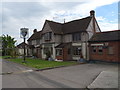
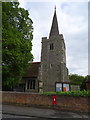
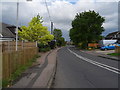
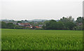
Photos of Great Burstead and South Green
Area Information
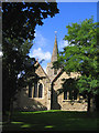
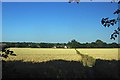
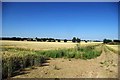
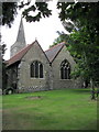
Great Burstead and South Green is a civil parish situated within the Borough of Basildon in Essex. You will find this area approximately 1.5 miles south of Billericay town centre, firmly classed as part of the town's built-up area. The modern parish covers an area of 7.4 km² and currently holds a population of 1,550 residents. This creates a living density of 209 people per square kilometre, giving the locality a compact, village-like feel despite its close proximity to a larger town. The postcode used for this location is CM11, and residents dial 01277 for local calls. The parish itself was formed on 1 September 1996, creating a distinct administrative boundary from part of the previously unparished area of Basildon. Living in Great Burstead and South Green means you are accessing a community with deep historical roots, including former Saxon settlements dating back to at least AD 500. While the area has evolved significantly since medieval times, it retains a specific sense of place defined by the church of St Mary Magdalene and the historic village of South Green. The combination of established history and modern connectivity makes it a notable choice for those seeking a rooted community near Billericay. Homes in Great Burstead and South Green offer a blend of traditional character and convenient access to wider Essex.
- Area Type
- Parish
- Area Size
- 7.4 km²
- Population
- 1550
- Population Density
- 209 people/km²
Demographics
The community profile of Great Burstead and South Green reveals a mature population structure. Data shows a median age of 70 years, indicating that the residents are primarily older adults. When considering the age distribution, the provided information covers the total population, which reinforces the notion of a settled district. You are looking at a demographic where the healthcare and accessibility needs of an older demographic are likely significant factors for potential buyers. Housing tenure in the area is heavily weighted towards ownership. Home ownership stands at 81%, suggesting that the vast majority of households in Great Burstead and South Green live in their own properties. This contrasts with younger market areas where rental properties often dominate the landscape. The accommodation type and household composition data reflect a total population count but do not specify single-person versus multi-generational living arrangements beyond the overall home ownership figure. This high ownership rate typically implies a stable residential environment with long-term residents rather than a transient population. Consequently, buying a home in Great Burstead and South Green usually involves entering a market of existing owners rather than new developers or house movers. This stability often correlates with the broader community sentiment found in parishes with such high retention rates.
Household Size
Accommodation Type
Tenure
Ethnic Group
Religion
Household Composition
Age
Household Deprivation
NS-SEC
Explore more demographic insights in this area
Go to Demographics tabPlanning
Planning Constraints
- Flood RiskPremium
- Ramsar Wetland SitesPremium
- Area of Outstanding Natural BeautyPremium
- Protected Nature ReservePremium
- Protected WoodlandPremium
- Crime RiskPremium